|
|
|
|
|
|
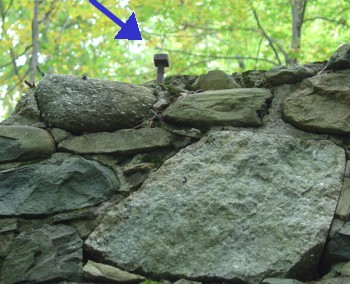
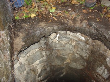
Wells, Cisterns, & Well Caps |
|
|
||||||||||||||||||||||||||||||
|
|
||||||||||||||||||||||||||||||||||||||||||||||||||||||||||||||||||||||||||||||||||||||||||||||||||||||||||||||||||||||||||||||||||||||||||||||||||||||||||||||||||||||||||||||||||||||||||||||||||||||||||||||||||||||||||||||||||||||||||||||||||||||||||||||||||||||||||||||||||||||||||||||||||||||||||||||||||||||||||||||
|
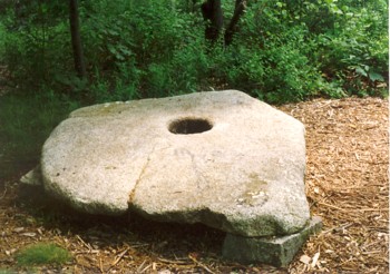
Two additional views of the same well cap at Governor’s Island, Hampstead. NH |
|
|
||||||||||||||||||||||||||||||||||||||||||||||
|
Two photographs of a slab of granite taken from the surface of the bedrock. It has well formed center hole. It located on the Babson Farm Quarry (Halibut State Park), Rockport MA. According to the interpretative huide for the park, this was used as a boat mooring. A tree stump with its roots was inserted into the hole. A hole was drilled in the trunk for a mooring rope, and the whole thing sunk in the harbor. We currently do not have independent confirmation of this theory. |
|
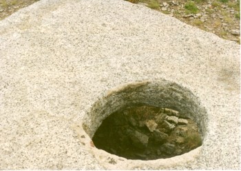
This photograph was provided by Steve Dimarzo Jr. It was taken around 1990 in Massachusetts, possibly Westport or Dartmouth. If you know its exact location please contact us. This was a well cap abandoned before the center hole was completed. The fracture patten on the side of the hole suggested it was being chipped out with some type of hammer. |
|
|
||||||||||||
|
|
||||||||||||||||||||||||
 |
|
|
|
|
||||||||||||||||
|
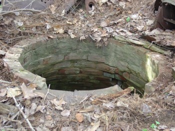
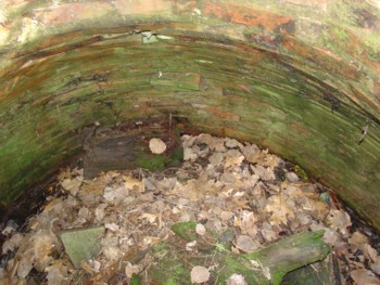
Cistern - Indiana This cistern is located on US 6 and near SR 6 in Indiana. It is an above ground bottle shaped cistern. A terra-cotta clay pipe was used as man-hole to access the inside. Water was pumped into the cistern with windmill. A metal overflow pipe can be seen on the left side near the top.
Kevin Mellott is in the photo (to show the size of the cistern compared to an average sized adult) and Tina Mellott took the photo. Kevin does historic restoration work and is a self-employed marine contractor. They live in a home which is on the National Register in Goshen, Indiana.
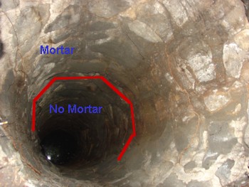
The interior of the cistern is on good condition and is lined with hydraulic cement to waterproof it. Two drain holes are noticeable in the bottom.
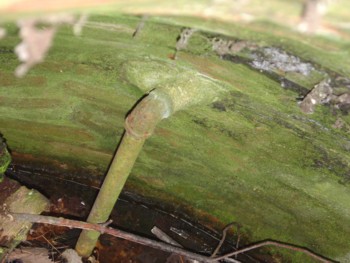
A water spicket for cistern is located adjacent to the windmill. |
|
|
|||||||||||||
 |
|||||||||||||
 |
|||||||||||||
 |
|||||||||||||
 |
|||||||||||||
|
|
|||||||||||||
 2005-2008, James E. Gage & Mary E. Gage. All Rights Reserved.") |
|||||||||||||


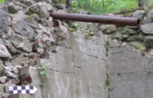
 Unfinished Well Cap