

What is it?
|
Below, you will find a number of oddities we have found over the years in the woods of New England. We thought you might enjoy trying to solving these history puzzles. If you think you know what it is or give up in frustration, you can click on the link to the answer. |
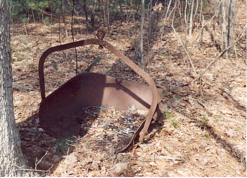
1. What is it?
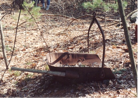
2. What is it?
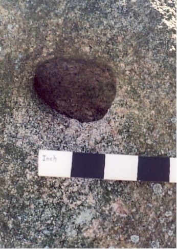
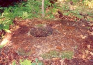
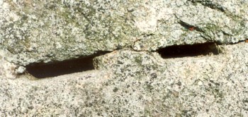
This hole was found in a large granite boulder in Harvard, MA. The inside of the hole is rounded and smooth. There is no evidence of tool marks. What is it?
3. What is it?
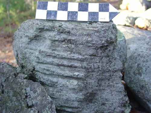
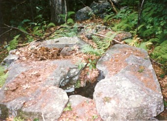
Examples of stones with raised ridges of rock across the stone are found throughout New England. Are these natural or man-made?
4. What is it?
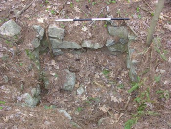
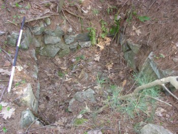
This small foundation was found on the Pingree Farm in Georgetown-Rowlet State Forest (Mass.). The farm was late 19th century large diary farm. This small foundation was found between the main house foundation and two barn foundations. The measuring rod in the photo is four feet long. It is about 4 1/2 to 5 feet square and presntly about 5 feet deep. Some broken glasware and other household debris was found inside. What type of building stood on this foundation?
5. What is it?
(Left) This was found in Hampstead, NH. It consists of two large slabs of granite with a crudely carved half circle in each half. (Right) This example is from New Hampton, NH. It consists of a single slab of granite with large hole cut in the center. Both these had the same function. The left one dates probably from circa 1740-1790 and the right example probable from the mid to late 1800s.
5. What is it?
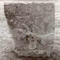
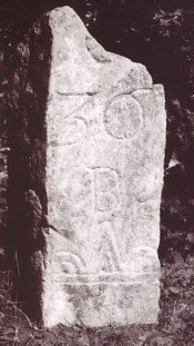
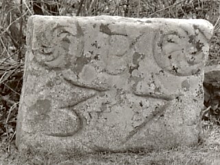
These three carved stones are from Newbury, MA. They are along the original route of Massachusetts Bay Road, a major highway in colonial era. They are carved with an oversize number and geometric decoration. What were they used for, who carved them, and when?
6. What is it?
These unusual marks are seen eastern Massachusetts, portions of New Hampshire & Maine and few other places in New England. They average 2 1/2 inches in length by 2 inches deep by 1/2 inch wide. the photo on the left shows a cross-section of the mark which has a trapezoid shape. The photo on the right shows a top view. What tool created these marks & what were they used for?