|
ANALYSIS & DISCUSSION
This section shows three different ways of organizing the data for this site. First lists the number different cairn designs per section. The second list focuses on the ratio of one type of structure to another. the third lists deals with man-made and natural features.
(1) Number of each design per section
Section A:
Cairns
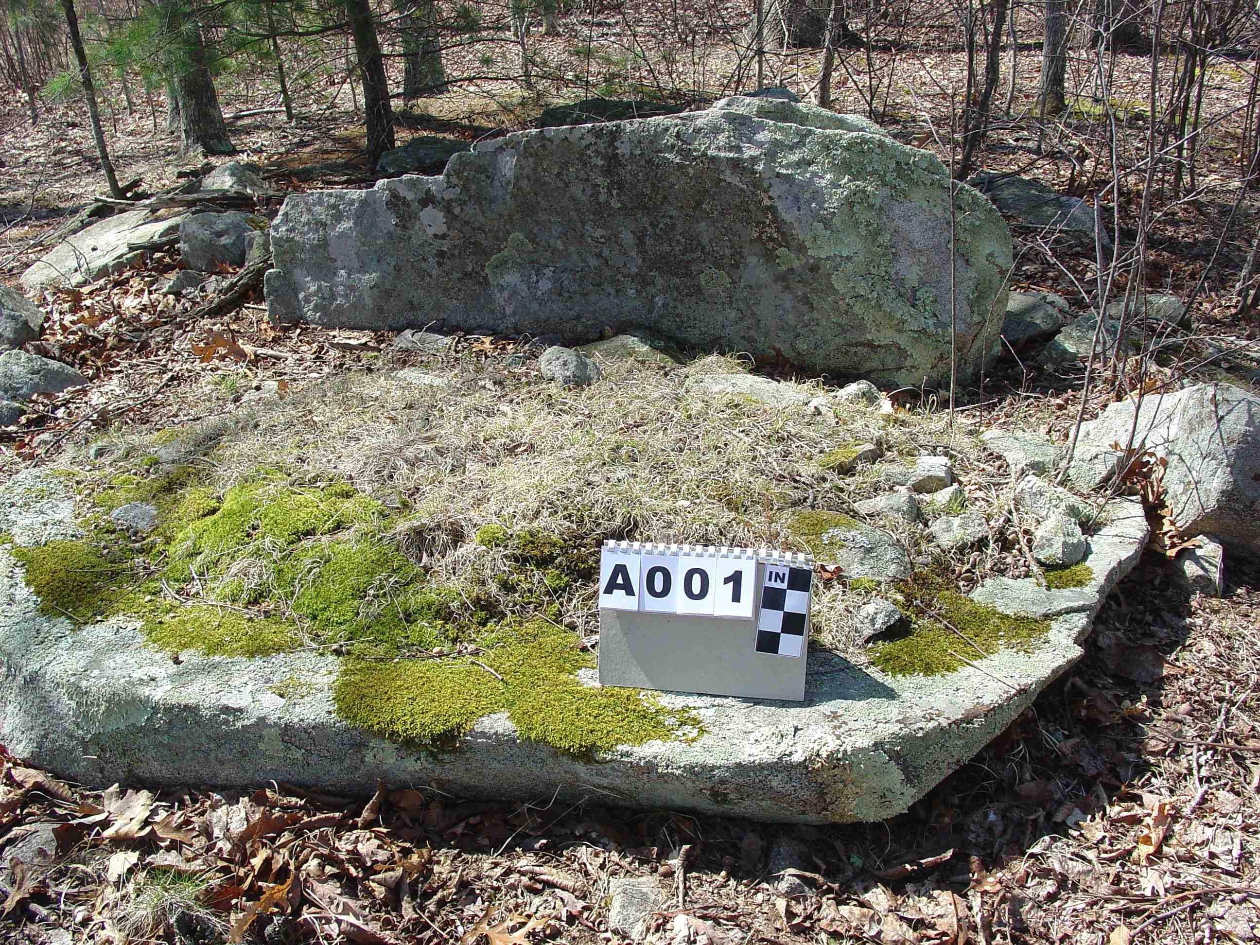
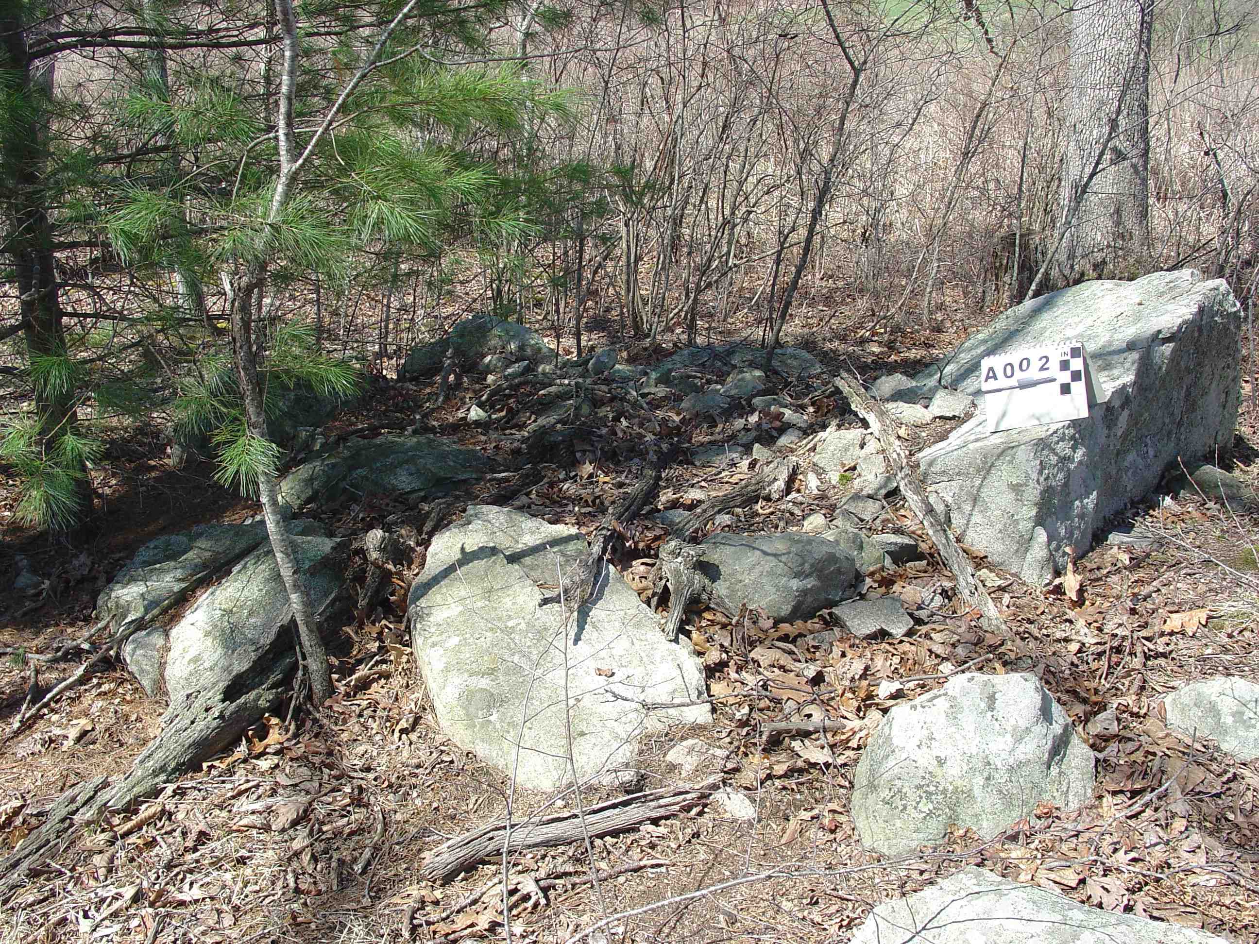
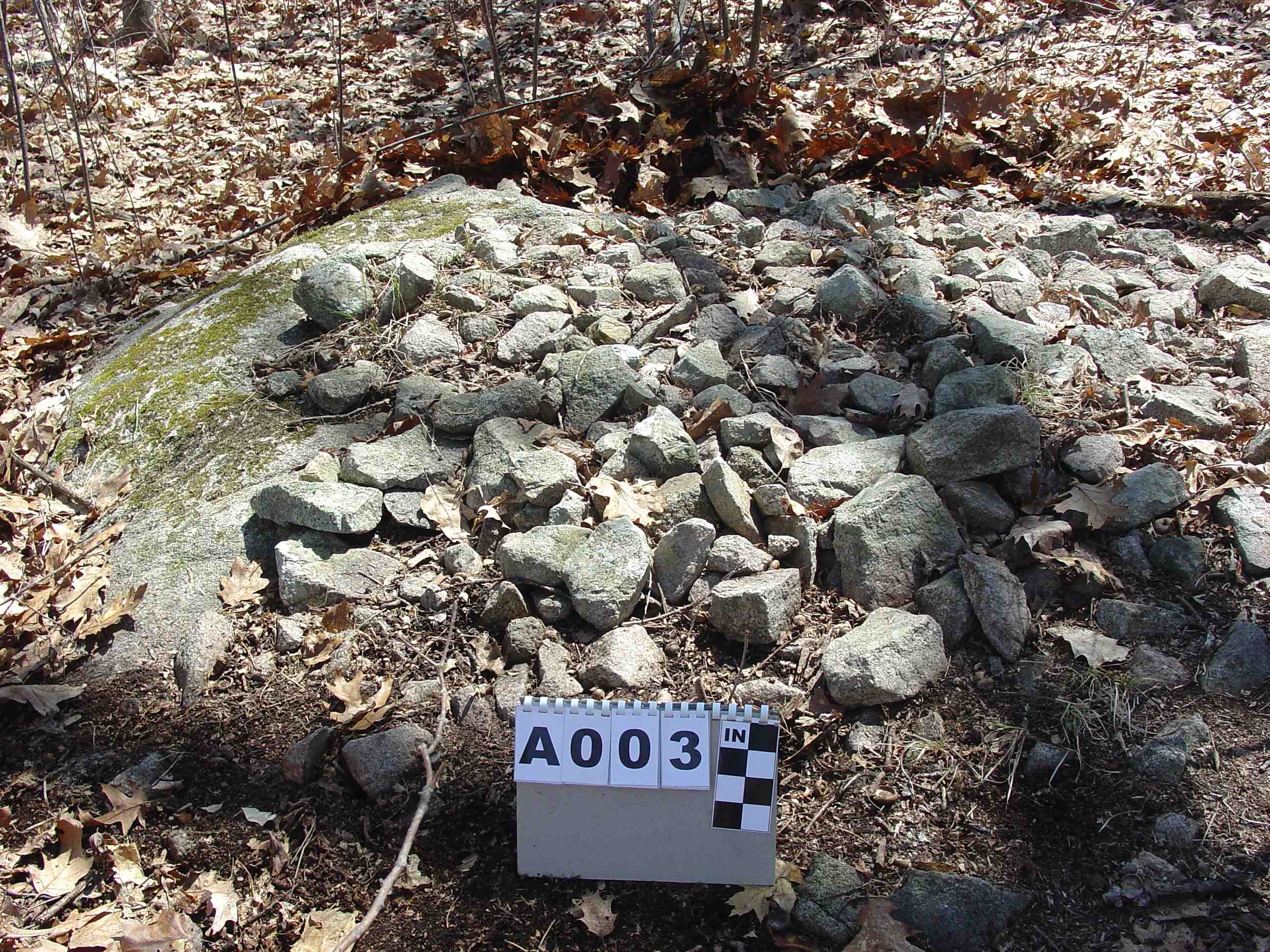
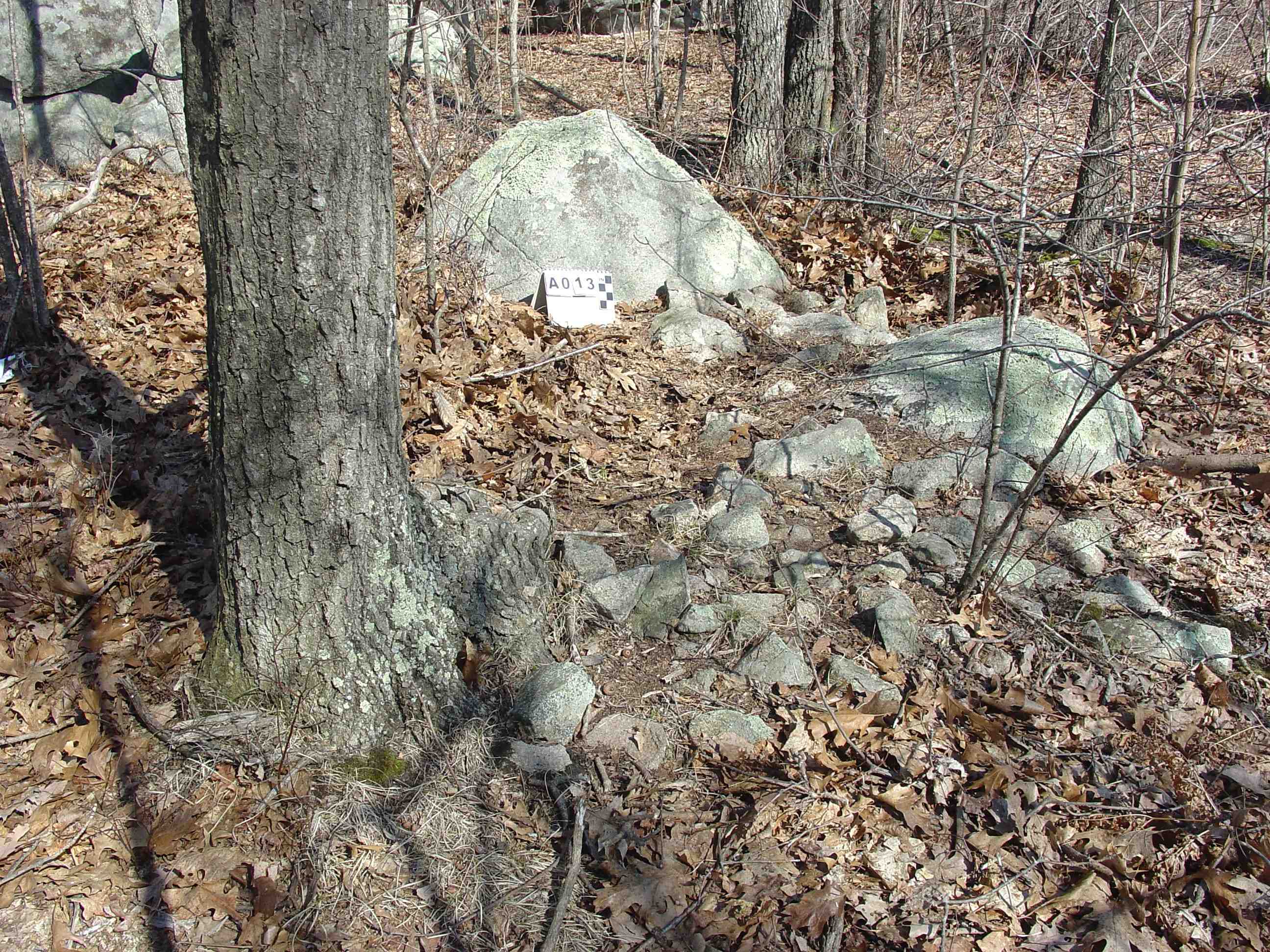
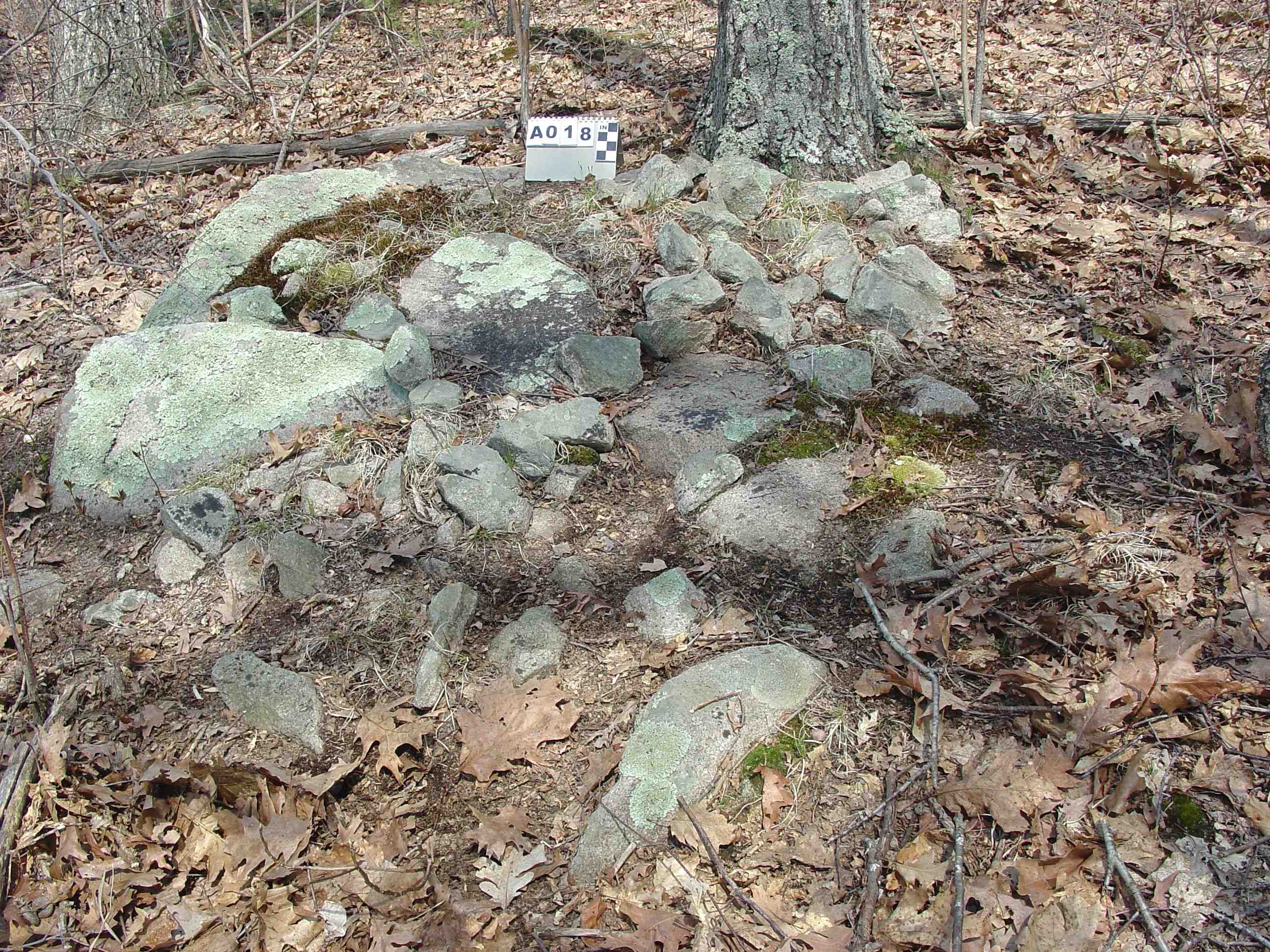
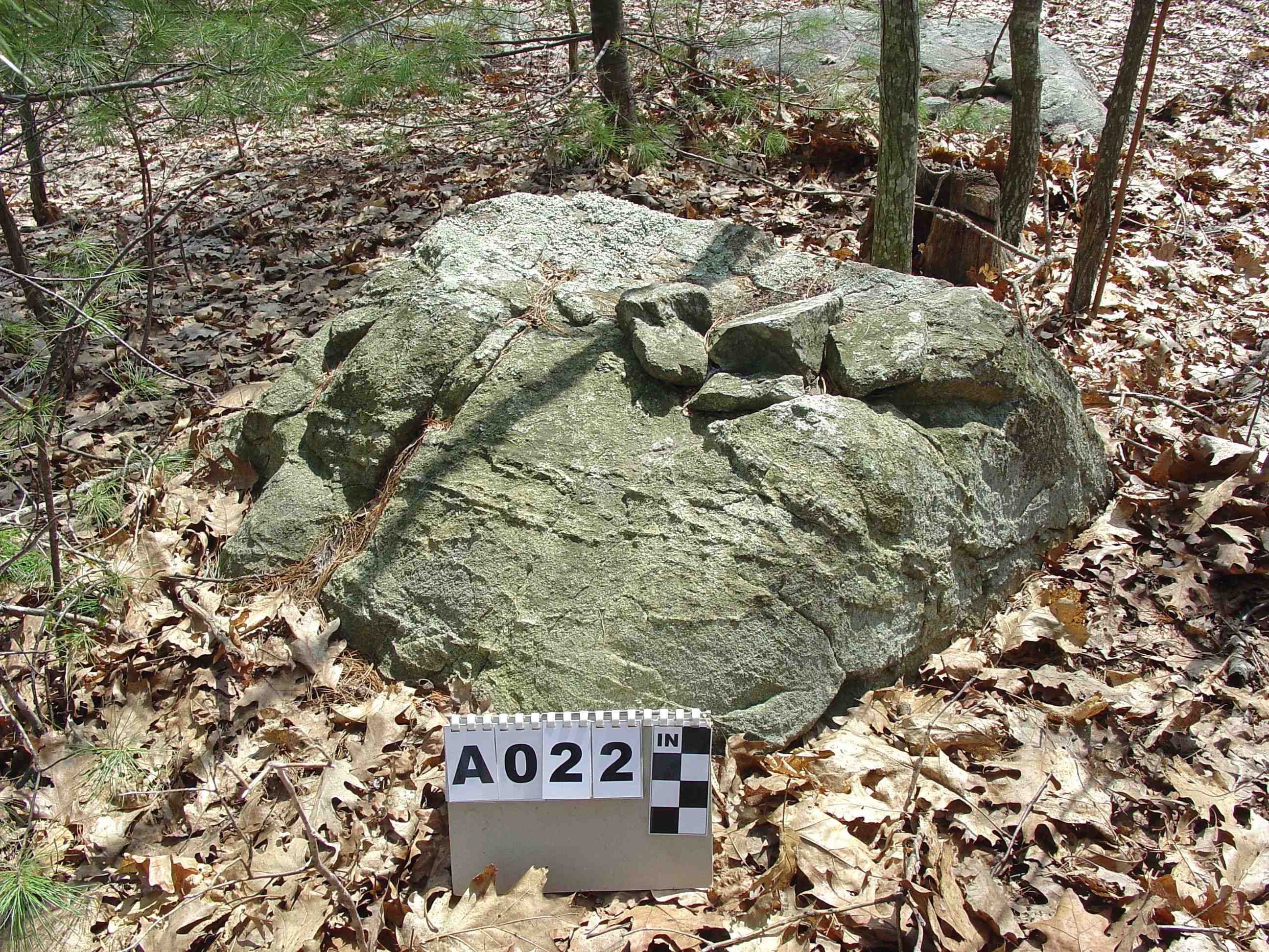
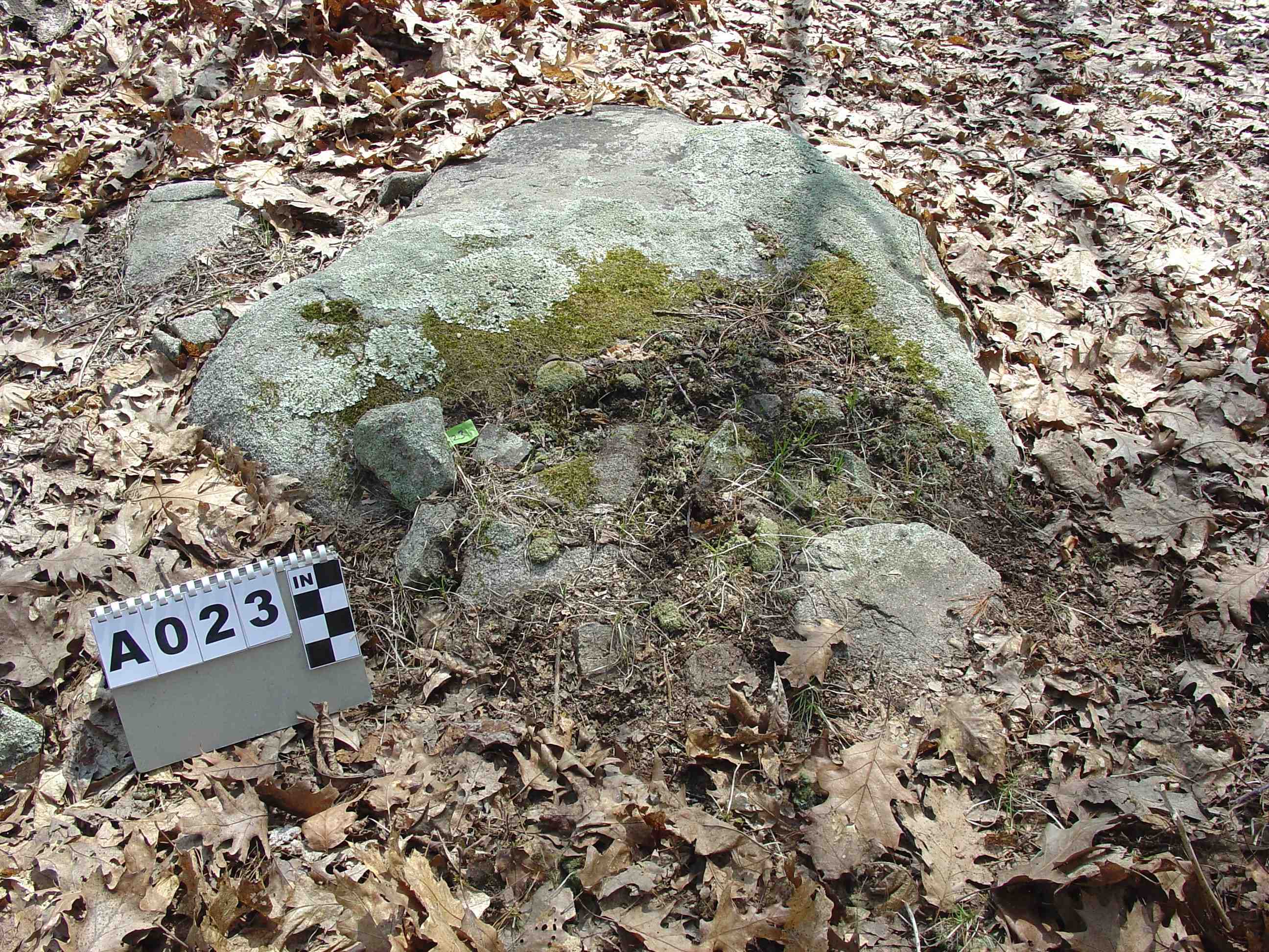
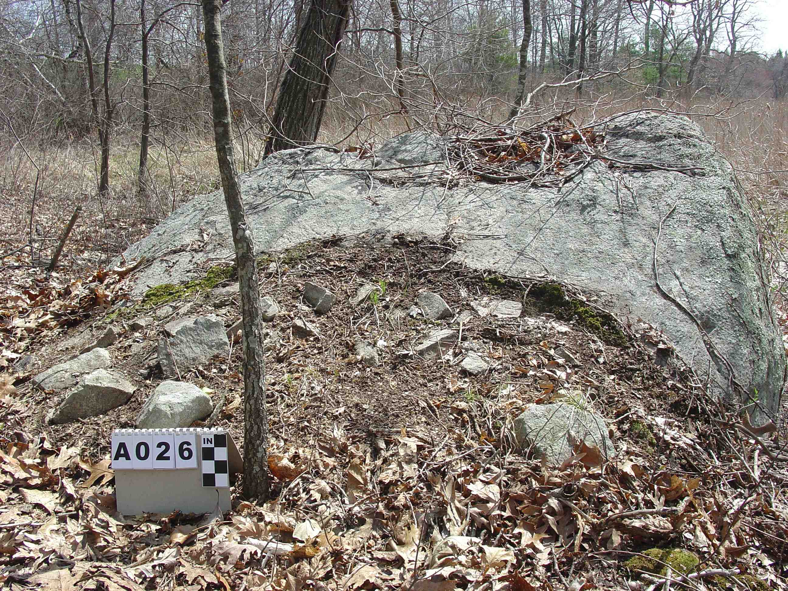
1 On Top of a boulder, single layer
1 Attached to a boulder, mound
Section B:
Cairns
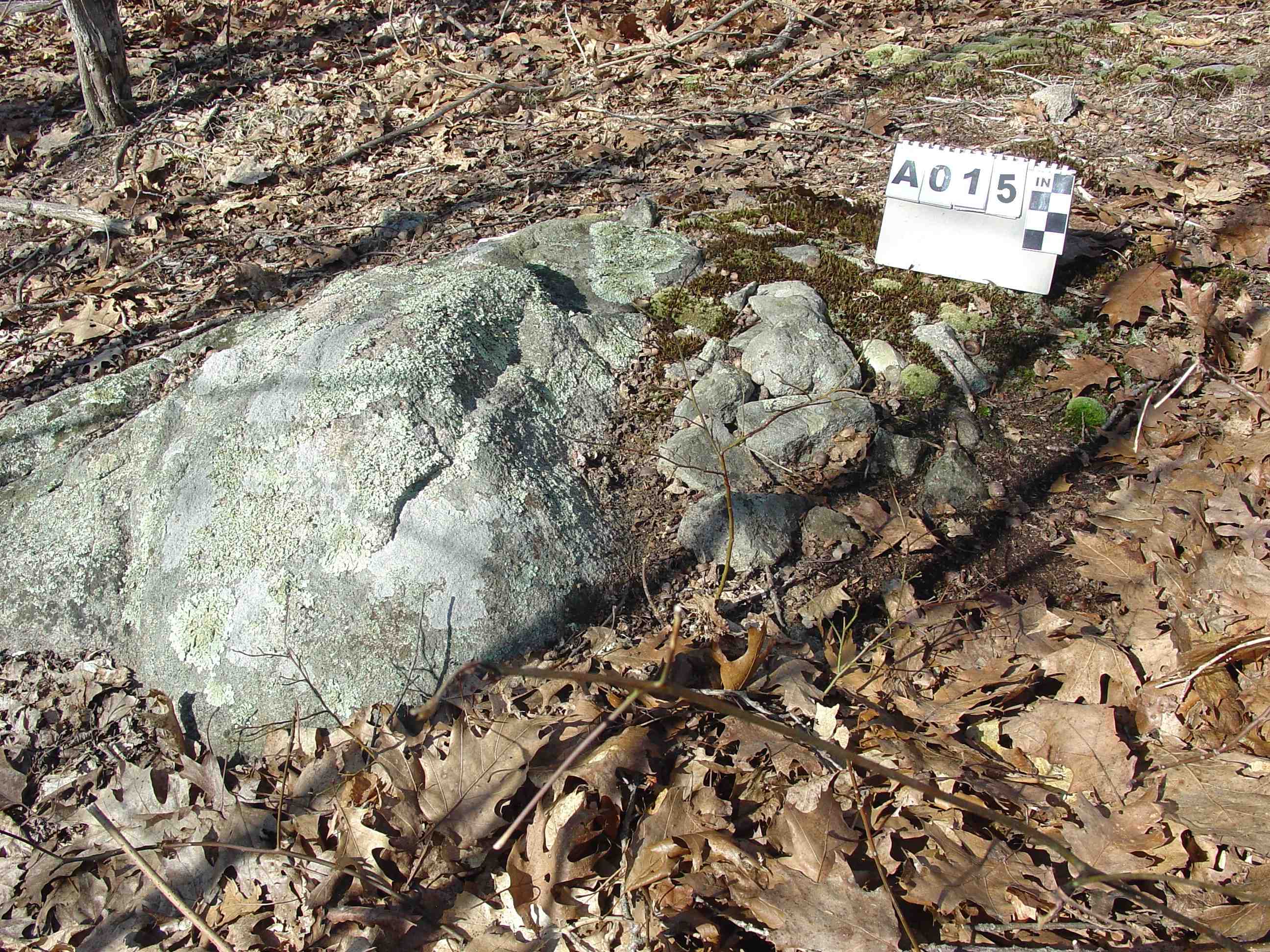
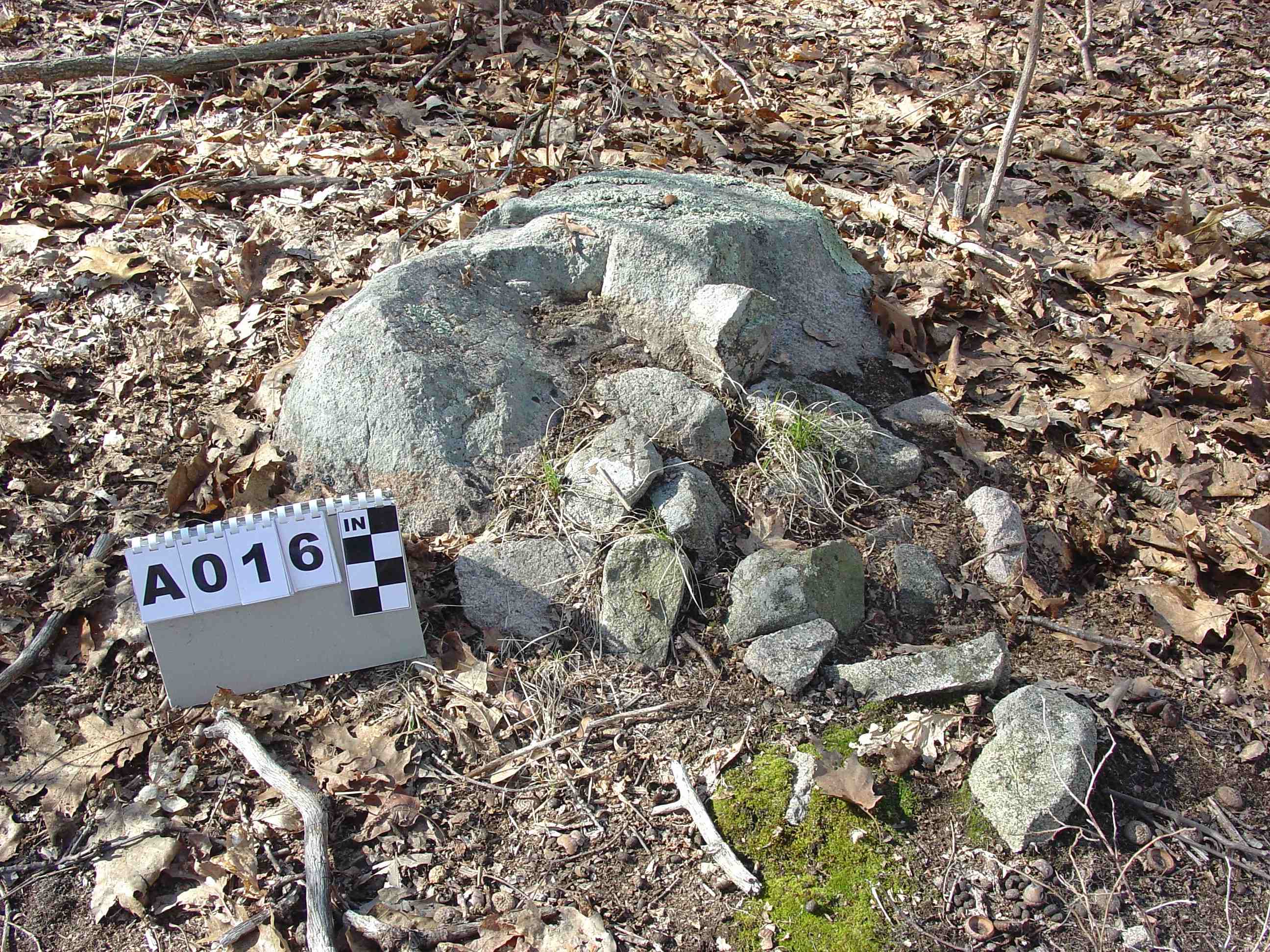
7 On Top of boulder:
3 single layer
1 multi-stone non-mound
2 mound
1 four stones on top
7 Attached to boulder:
6 mound
1 two boulders with mound
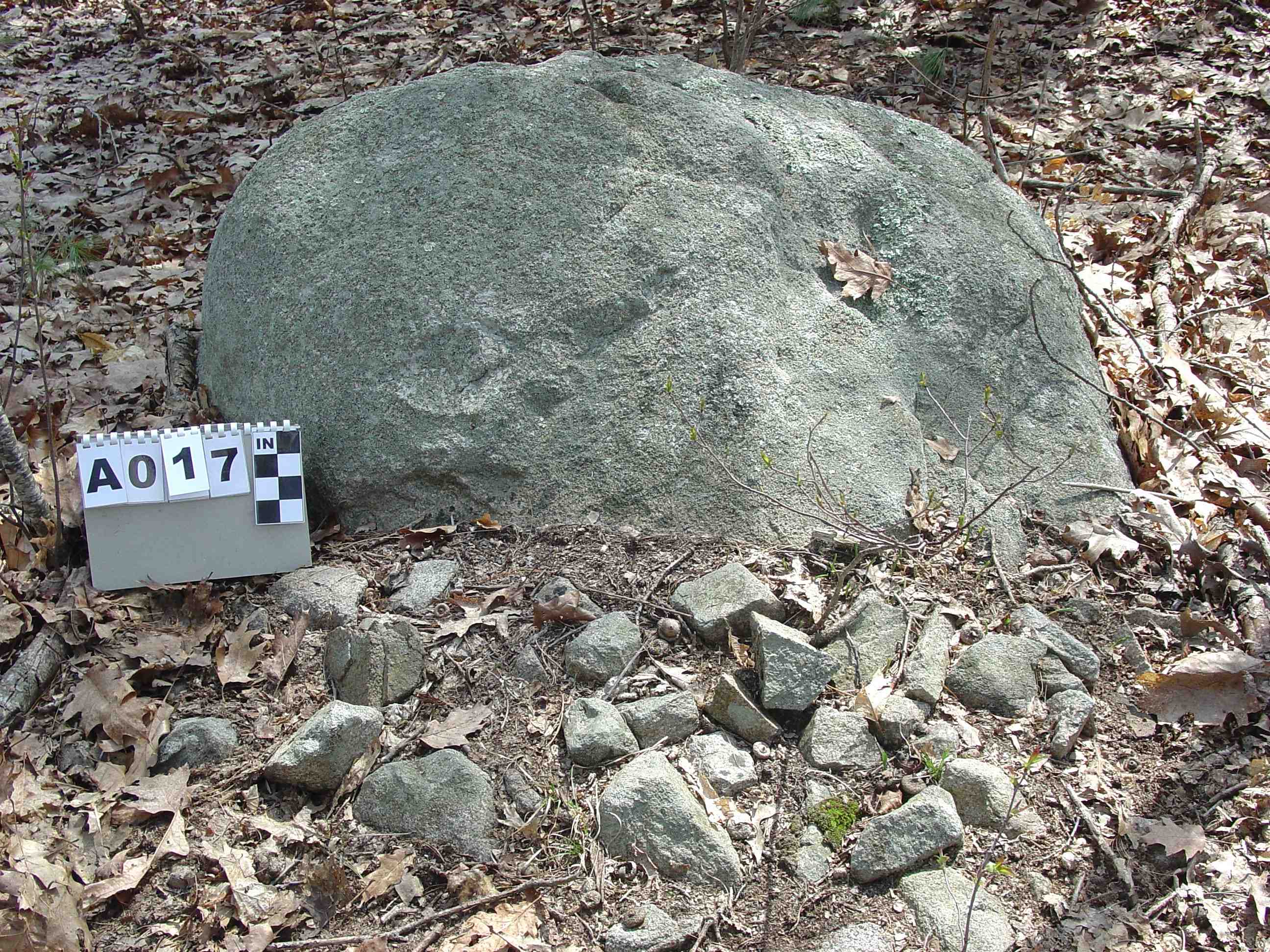
8 On Top Trailing to Ground:
1 mound
4 single layer
3 non-mound
2 On Ground: mound
1 Split Stone cairn, stone surrounds base, no stone in split
Double (Combination Two Cairns in One)
3 Attached to side and On Top
1 Attached to side and On Top Trailing to Ground
1 On Top and On Top Trailing to Ground
1 On Top and On Top
1 On Top and Split with 3 stones inside split
Other Structures
1 Quarried boulder, split with wedge holes
(2) Ratios (basic designs)
Section A
2 Cairns associated with a boulder
Section B
2 On Ground Cairns
31 Cairns associated with a boulder
2 Split stone cairns
(3) Features (list only)
Man-made
Large Stones
Perched Stone
Shelf-niche
Quarried flat wedge holes
Raised dirt road bed
Natural
River
Wetlands
Meadow
Ex-large boulders
Discussion of Features
Large Stones on Cairns:
#2 surrounds outer edge #27 on edge of base stone and cairn on top
#4 single on one side #29 three on outer edge of cairn
#6 two on opposite sides at outer edge #30 one on bottom-outer edge
#7 see perched slab #32 One on outer edge of cairn
#8 one on edge18 one on outer edge #33 one on outer edge of cairn
Large stones except in the case of the perched slab are found on the outer edge of the cairns. In some cases, the large stones appear to partially hold in the smaller cairn stones. The large stones could also have symbolic meaning.
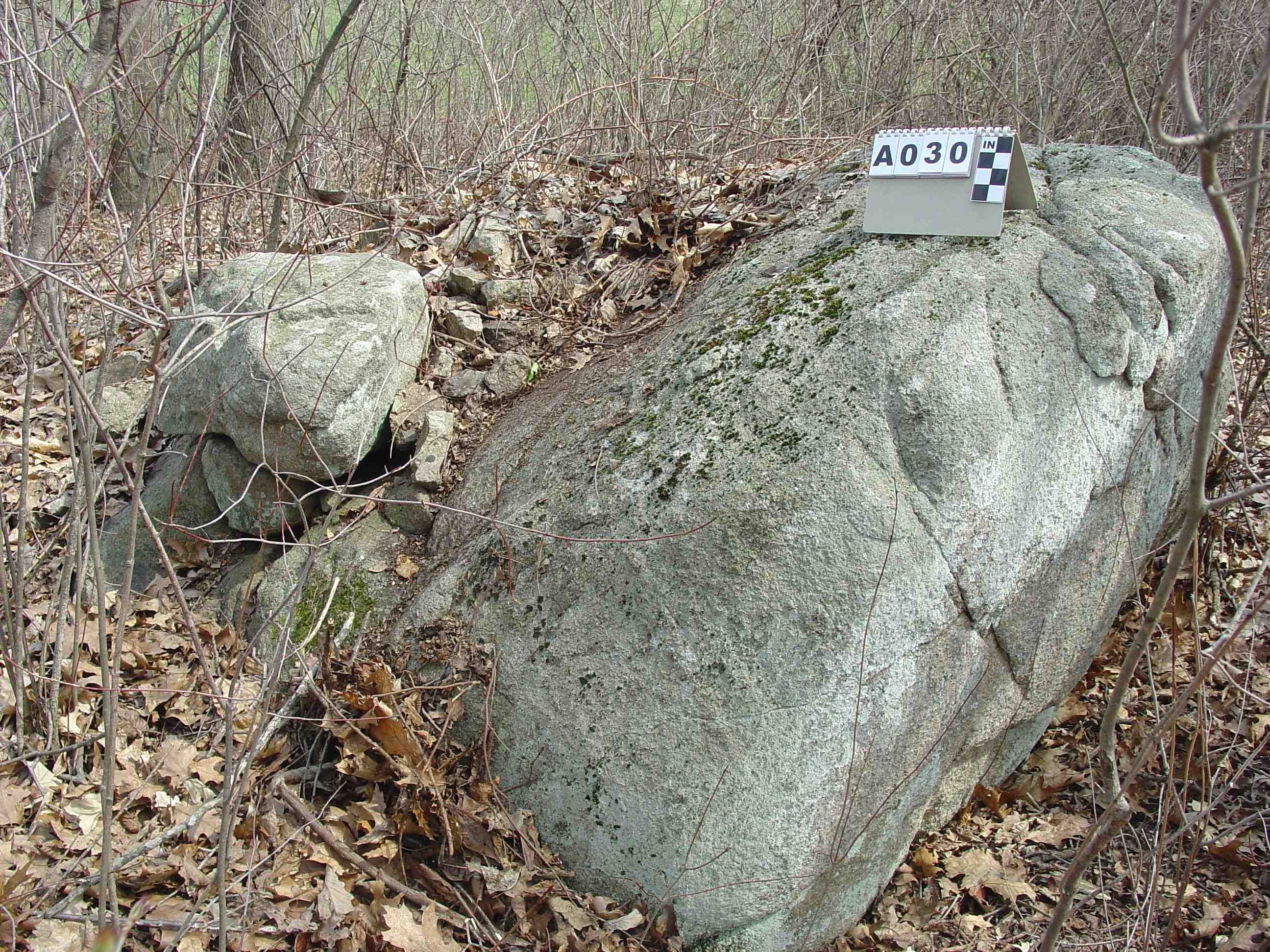
Perched Slab:
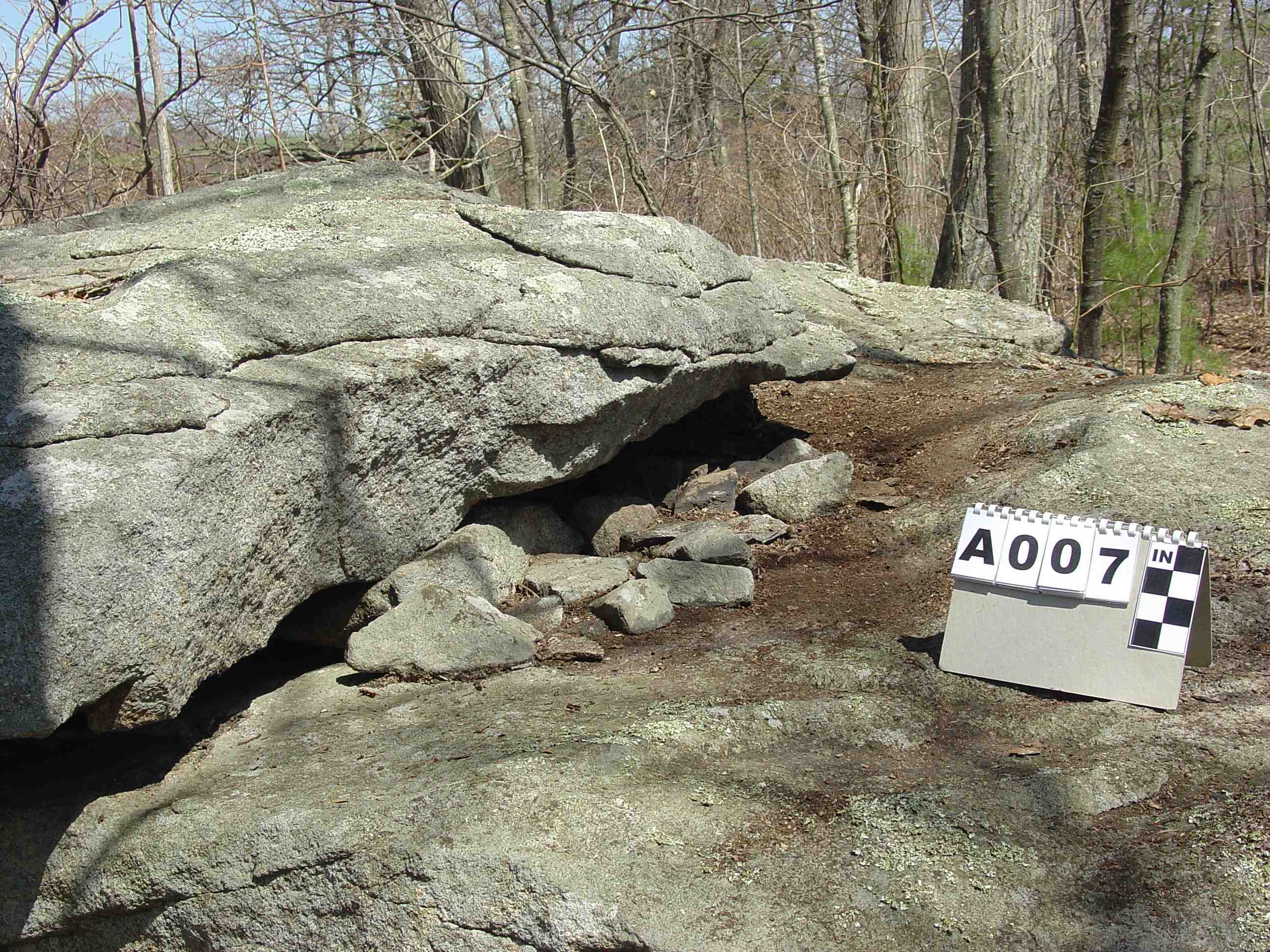
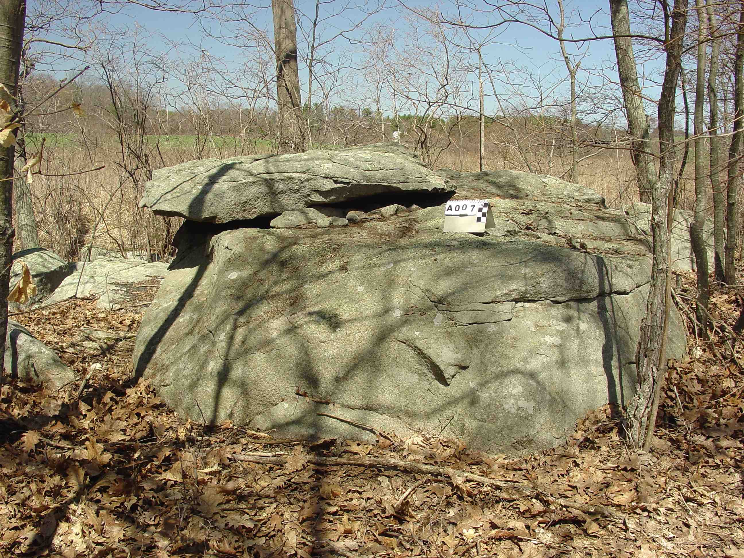
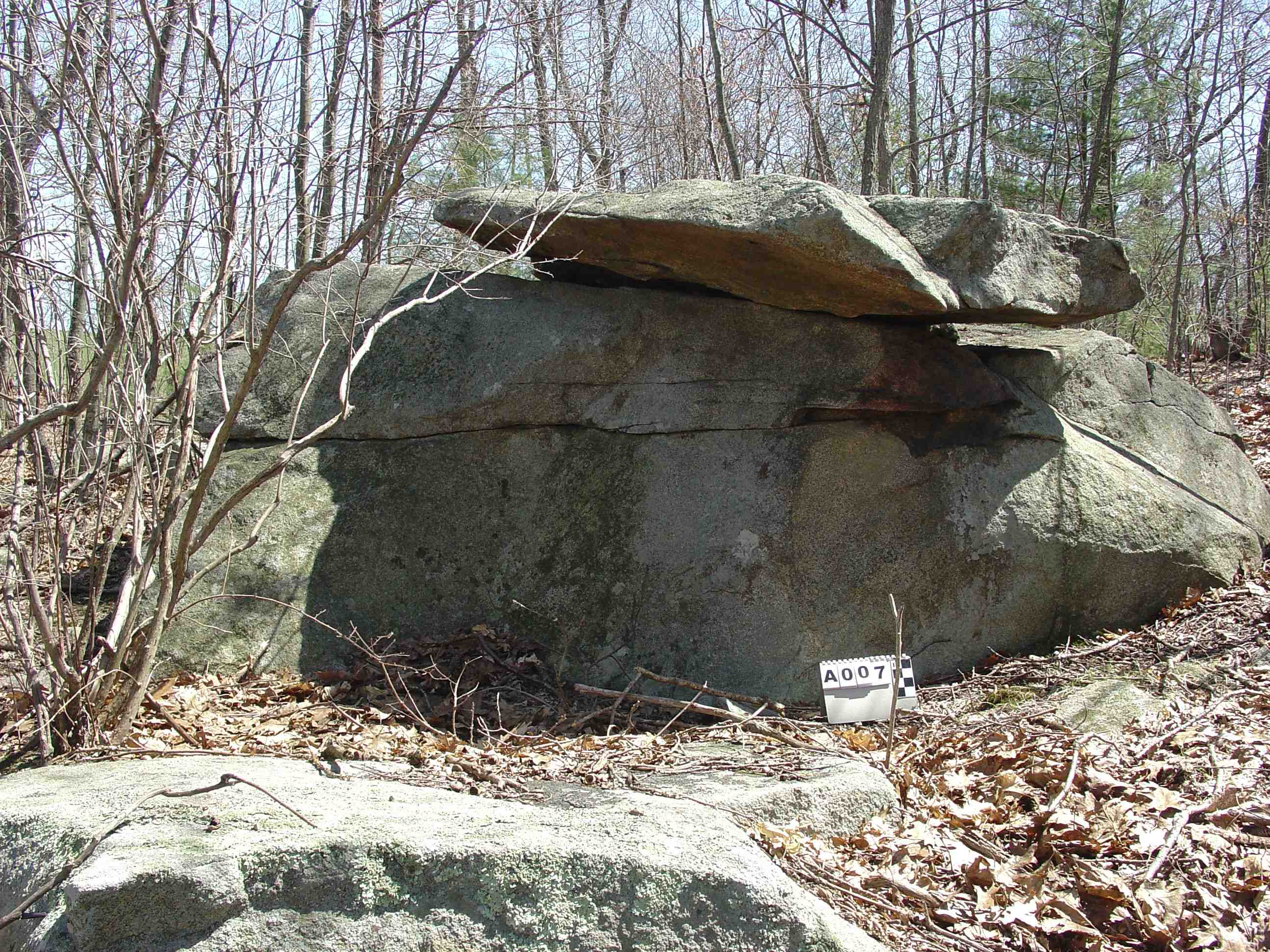
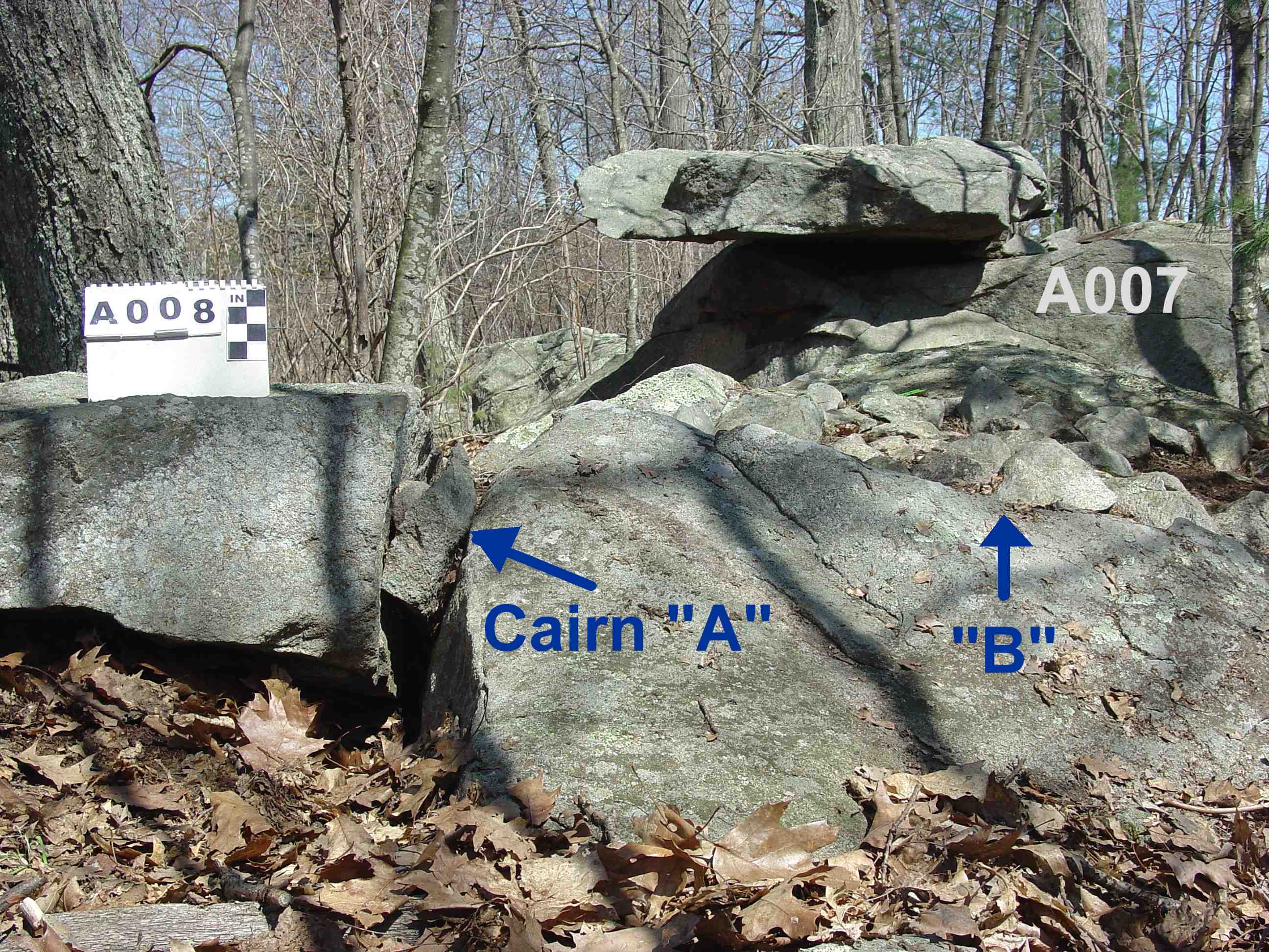
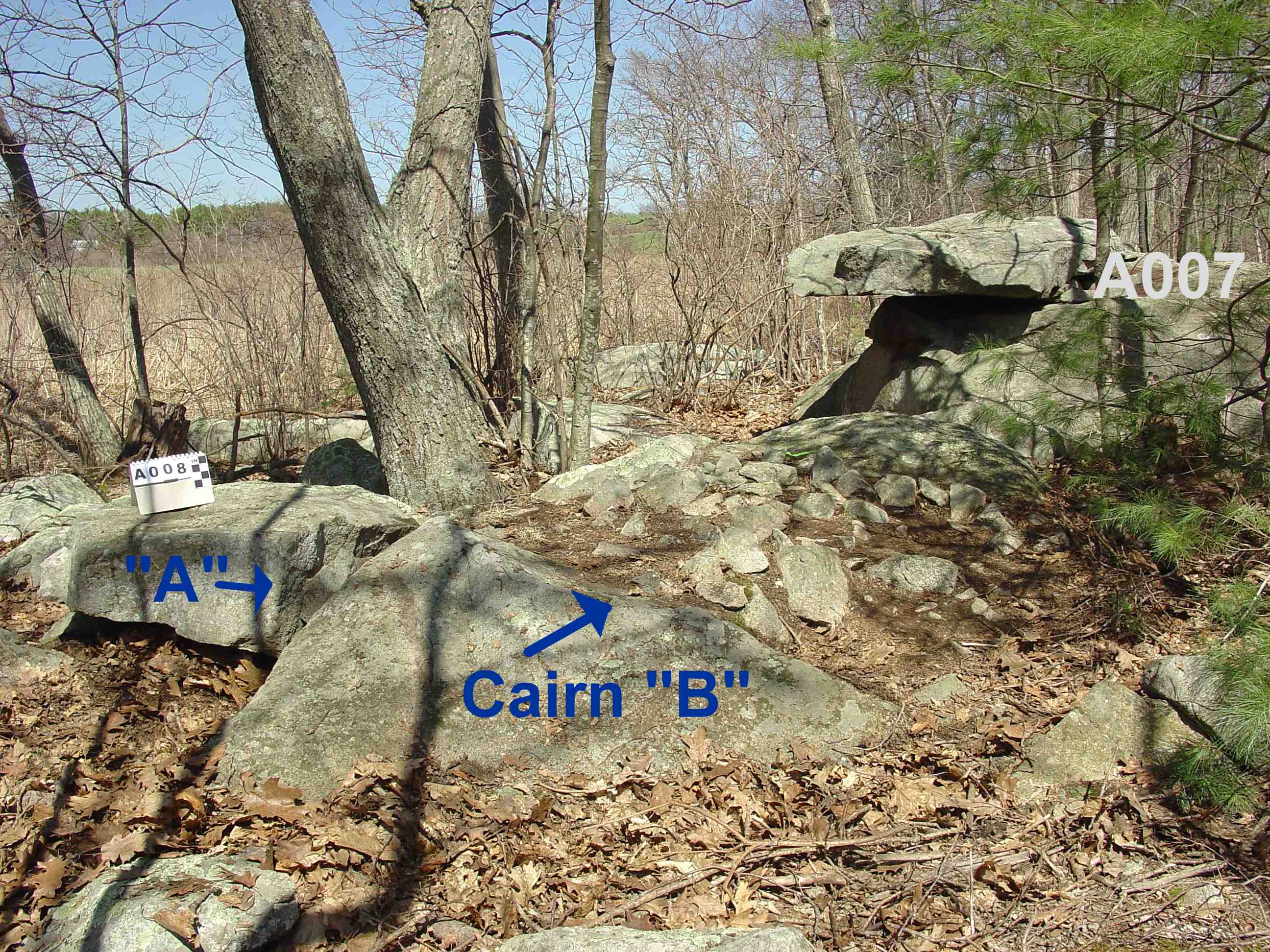
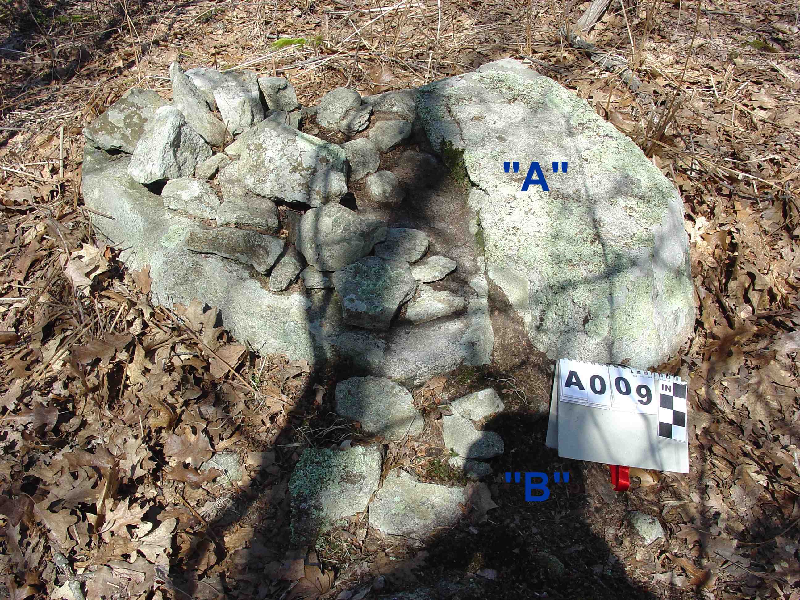
#7 has an ex-large slab perched half on and half off ex-large base boulder. The smaller cairn stones were placed partially under edge of slab on top side of boulder. The unusual perched slab cairn is five feet away from #8 a split stone cairn.
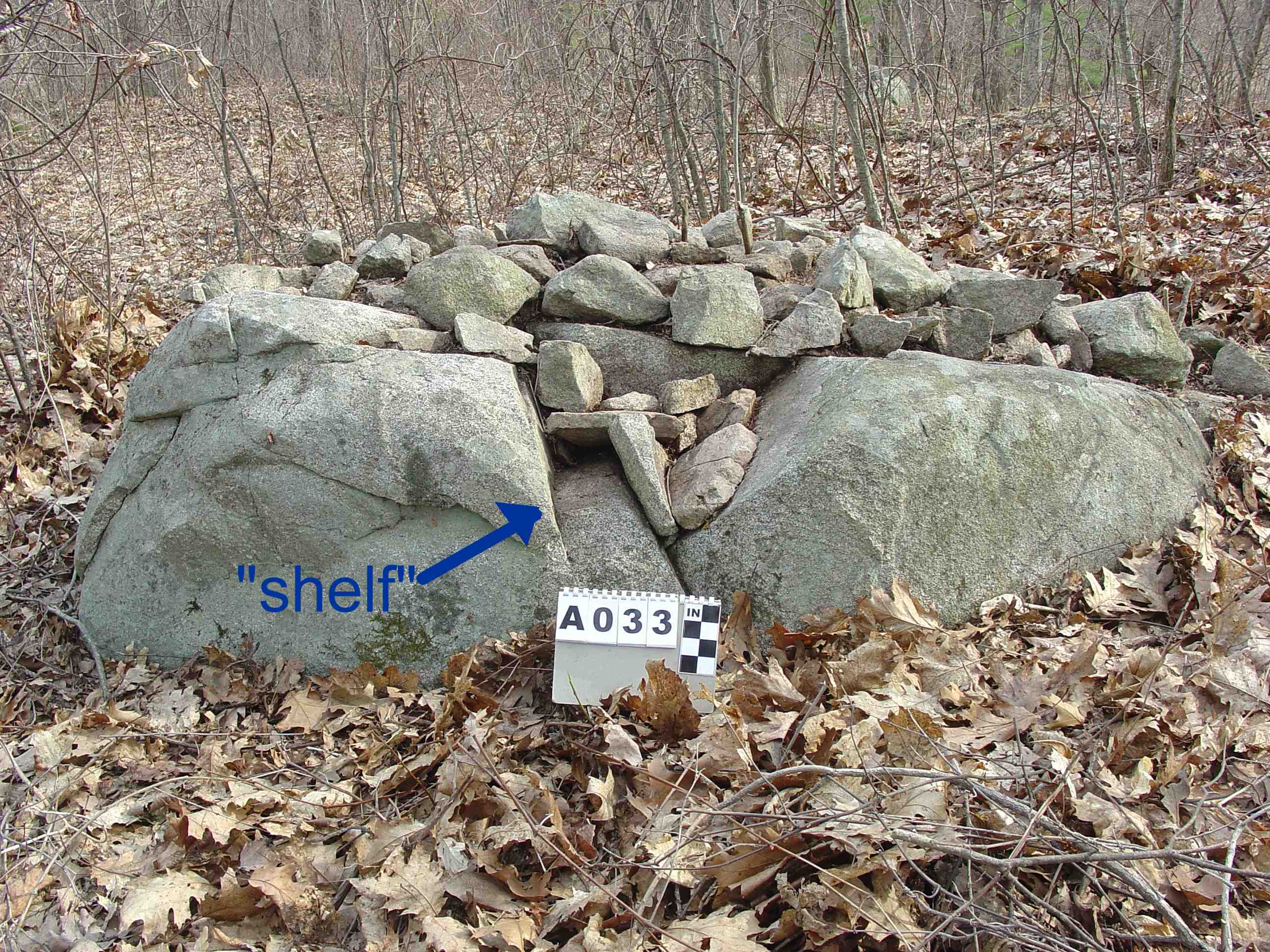
Shelf-Niche:
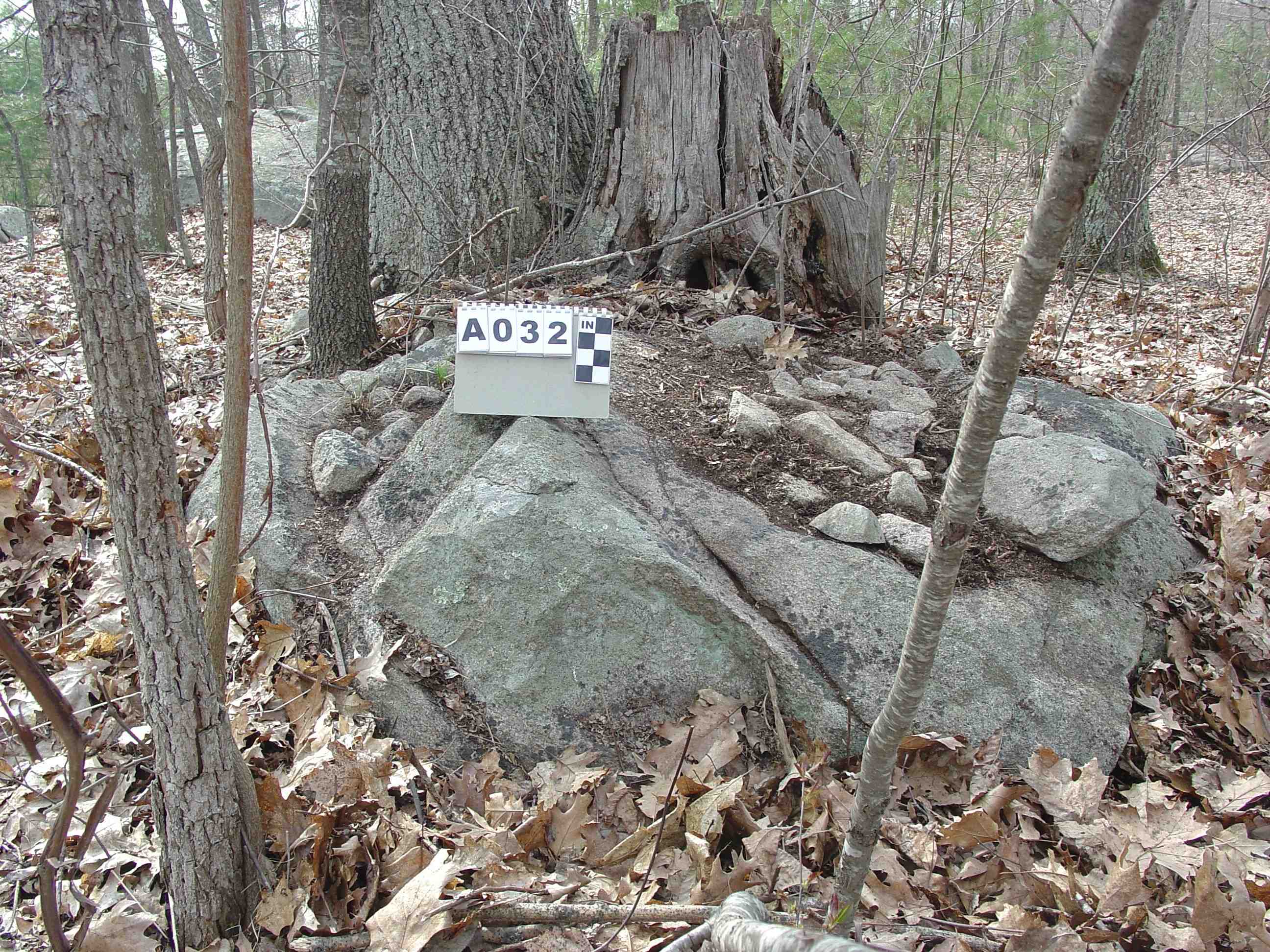
#33 is high boulder based cairn. The south side of the base boulder is covered with a cairn. On the north side of the base boulder had a large chunk of stone missing. The indented space has a flat bottom and slanted sides creating an open box-like effect. Cairn stone was used to fill-in the indented box and at same time to create a three-sided open topped shelf-niche. The shelf-niche faces north. The cairn is located on the east edge of the cairn site next to the meadow.
Quarried Boulder:
#25 is an ex-large boulder with a natural split on one side with small stones wedged in the split. A second split is on opposite end which exhibits flat wedge holes unevenly spaced. The holes were sparingly spaced out as to cut only as many as needed to split off the top section of the boulder. The split off piece was left in place. The workmanship is poor quality suggesting limited knowledge of quarry method and/or limited tools. Drills and cape chisels used to cut the holes need daily sharpening. If the man who cut the holes had only one cape chisel it would account for the reduced number of holes to conserve his tool. The boulder may not have split as well as he had hoped and therefore the block of stone was left in place and the boulder was not further worked to remove more blocks. No other boulders exhibit quarry marks.
Road:
A short length of built-up dirt road extends into the cairn field on the southeast side. It bisects a few cairns, three on meadow side are separated from others on the southeast side. The road appears to lead in from the swampy-wetlands area next to the river and end on the harder, dry land on which the cairns were built. It is near what is today the edge of an open meadow with good grass/hay.
Tidal River:
The river snakes around the outer southeastern perimeter of the cairn site.
Wetlands:
Wetlands border the site on the east, south and west sides.
Meadow: meadow borders the site on the north side.
Ex-large Boulders:
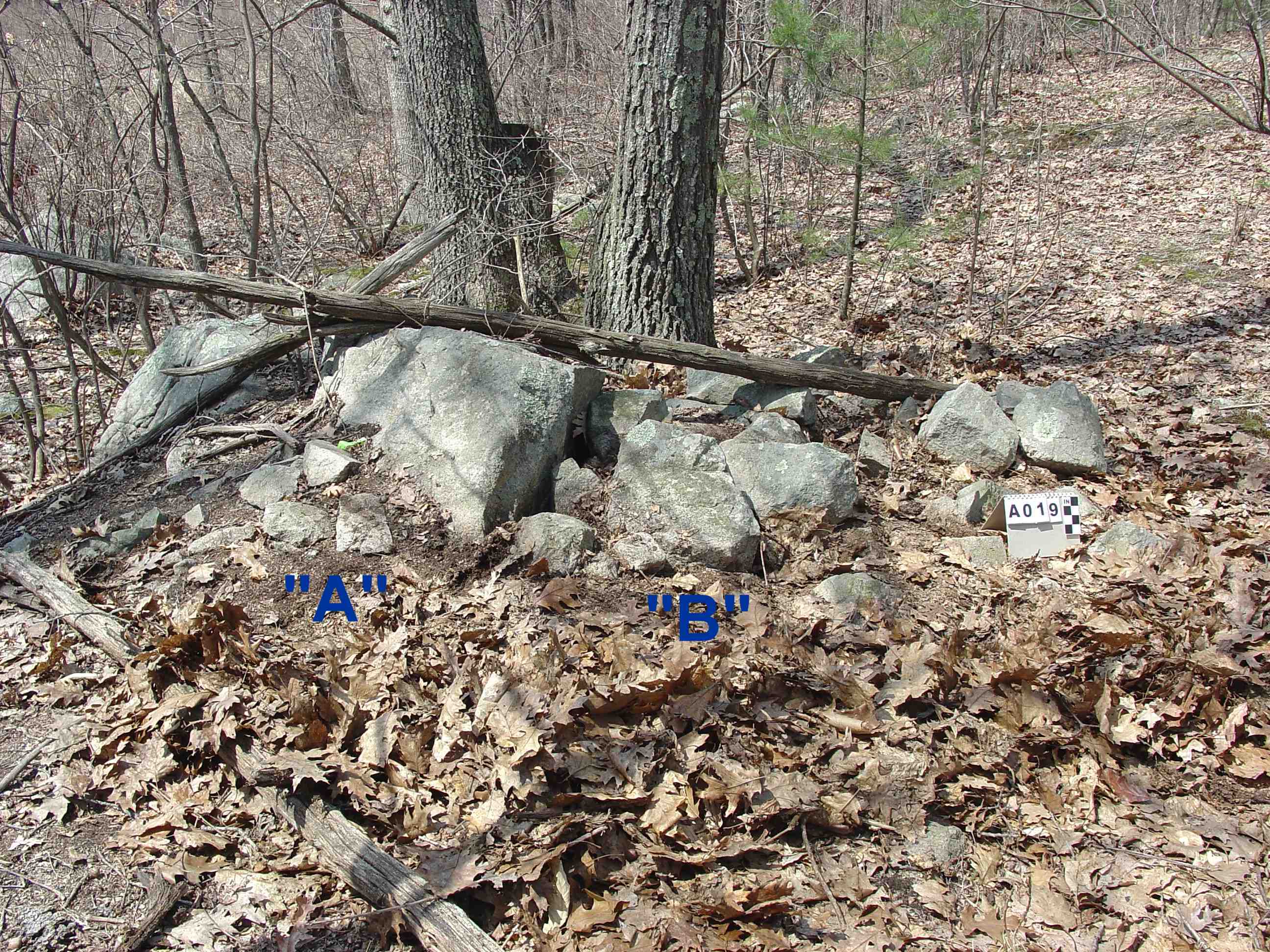
Four ex-large boulders are spaced out within the confines of the cairn site. Three of the ex-large boulders form a large elongated triangular layout. The west side of the triangle abuts the wetlands. The south and east sides of the triangle are bordered by cairns. On the west side next to boulder B2 are two cairns #8 a split stone cairn and #7 the perched slab cairn are on the north side of the boulder placing the two cairns on the outer edge but inside the triangle. Next to boulder B1 are three cairns #s 4, 5, & 6. Number 4 is attached to a boulder and number 5 has a large stone with an attached cairn. Number 6 is next to the boulder B1. With the exception of the cairns # 7 & #8 there are no cairns inside the triangular area. The fourth ex-large boulder is on perimeter of cairn site near outer southwest edge of site.
Comparisons
Section B
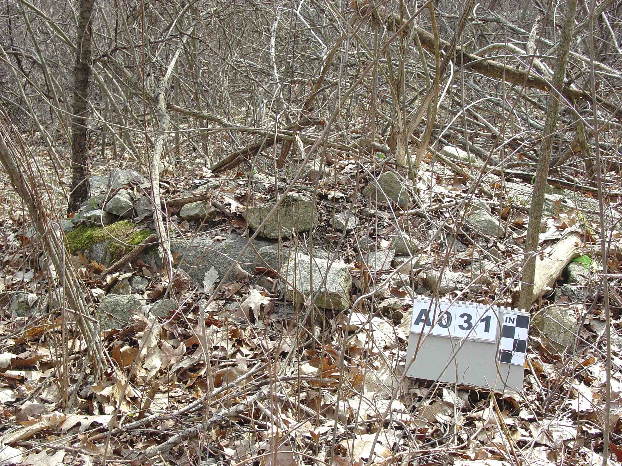
1) Split Stone Cairns
#8 has a split on one end and a cairn on top adjacent to the split. The split has three stones placed inside. This split stone cairn is located next to the perched stone cairn, an ex-large boulder (B2) and is situated on the northwest edge of the cairn site next to wetlands.
#11 has a narrow split without stone fill inside. Surrounding threes sides of the base is an attached cairn on the ground. This split stone cairn is located on the south end one cairn in from the southwest edge of the site next to wetlands and river.
The two split stones exhibit different attributes. One has three stones filled in the split, the other does not. One has a cairn on top of the base stone while the other has a cairn surrounding the base. This suggests the two split stone cairns had different purposes.
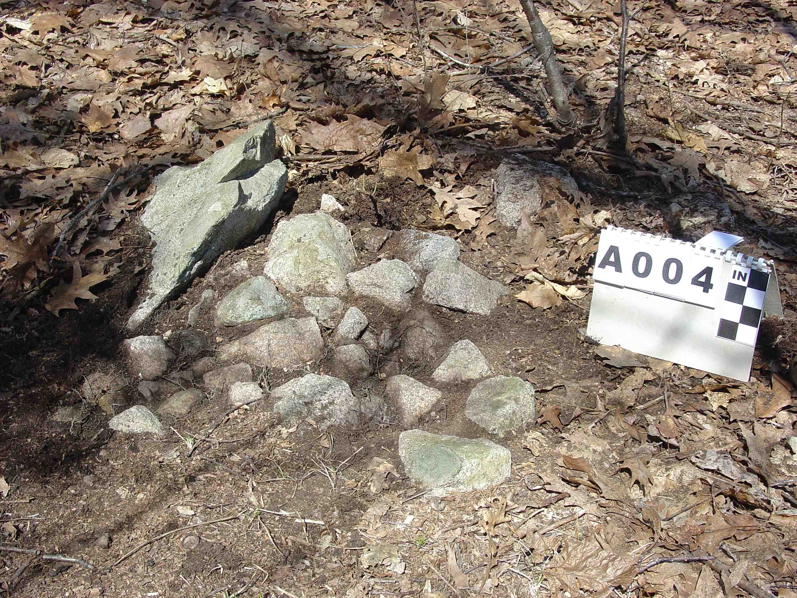
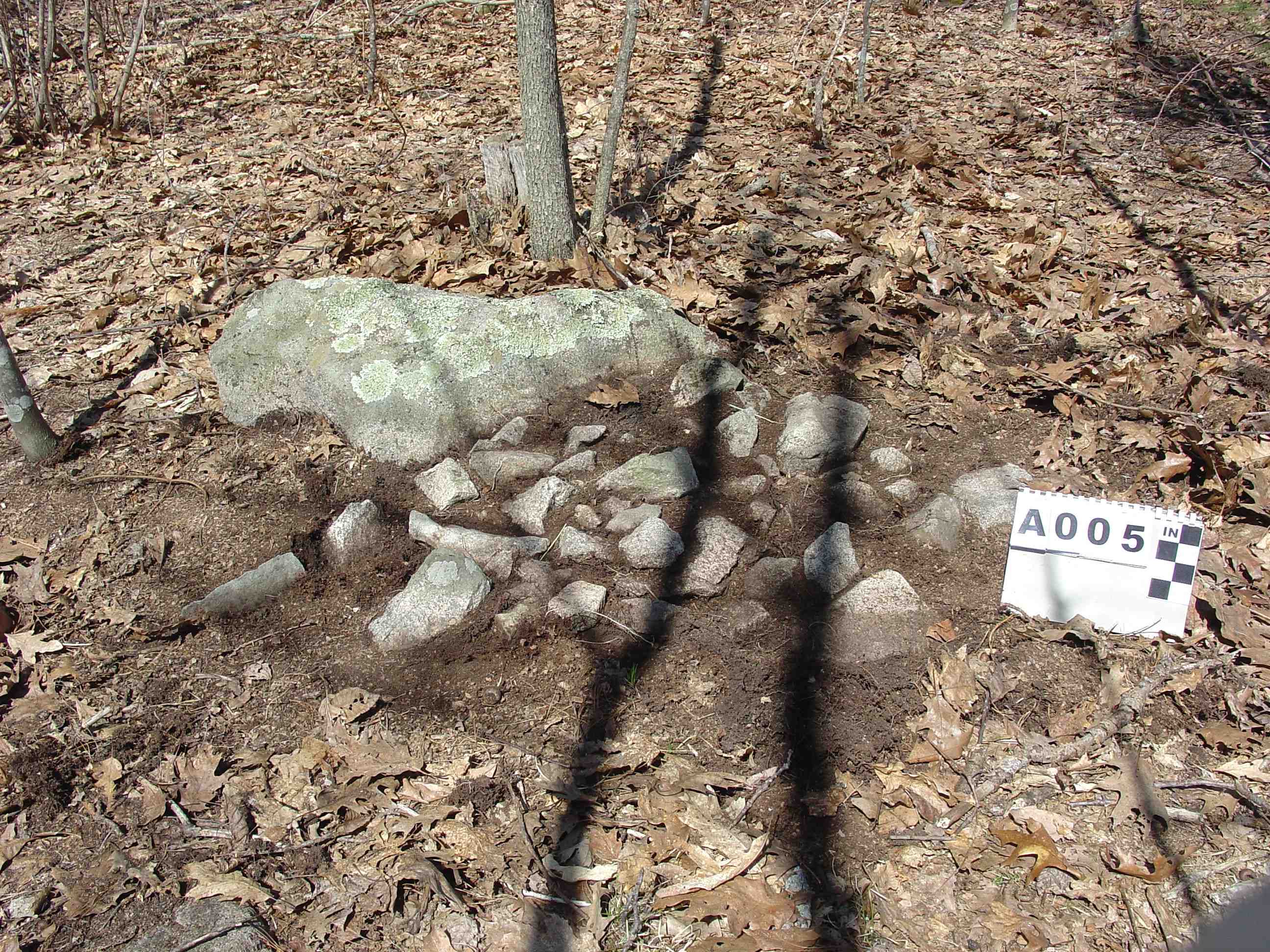
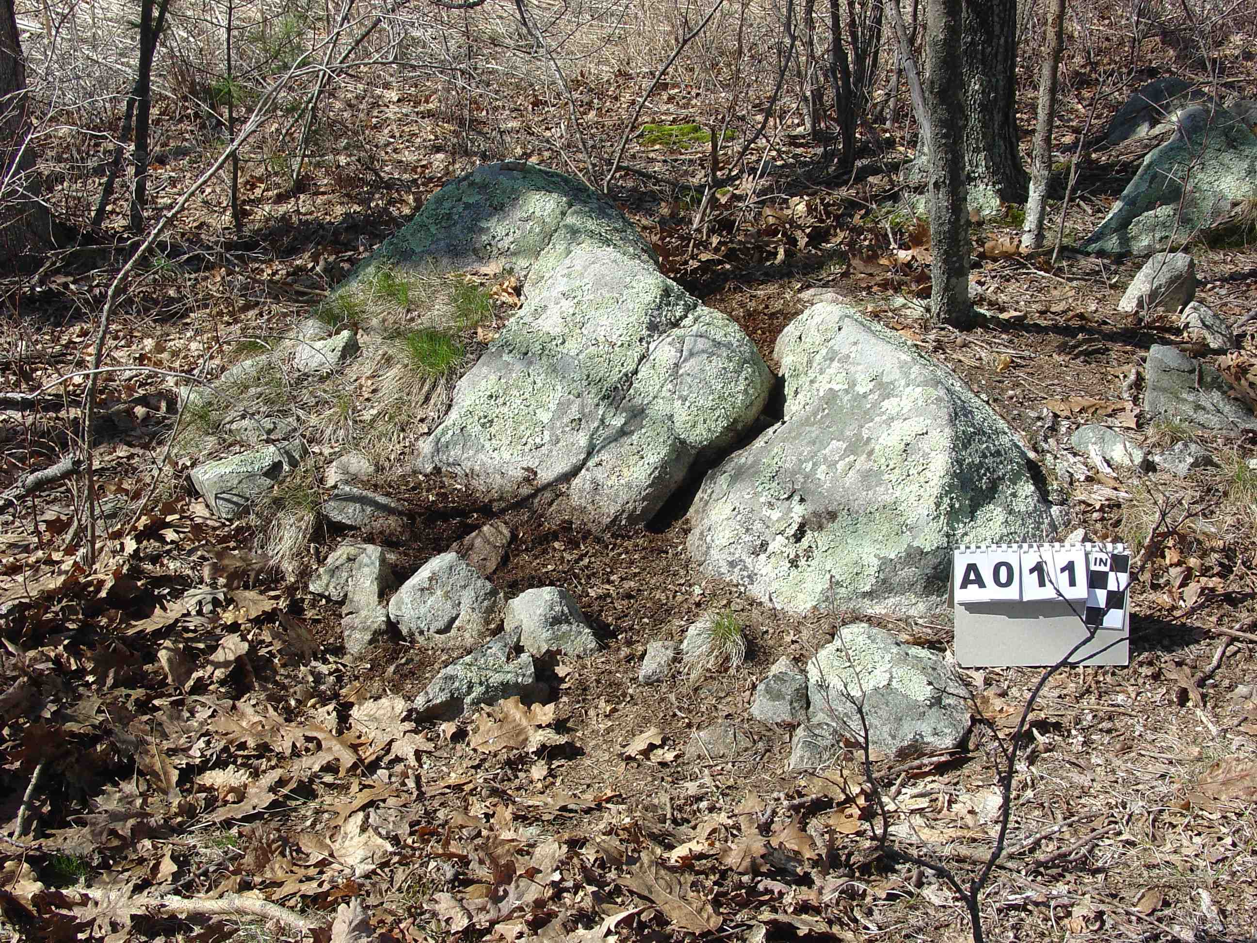
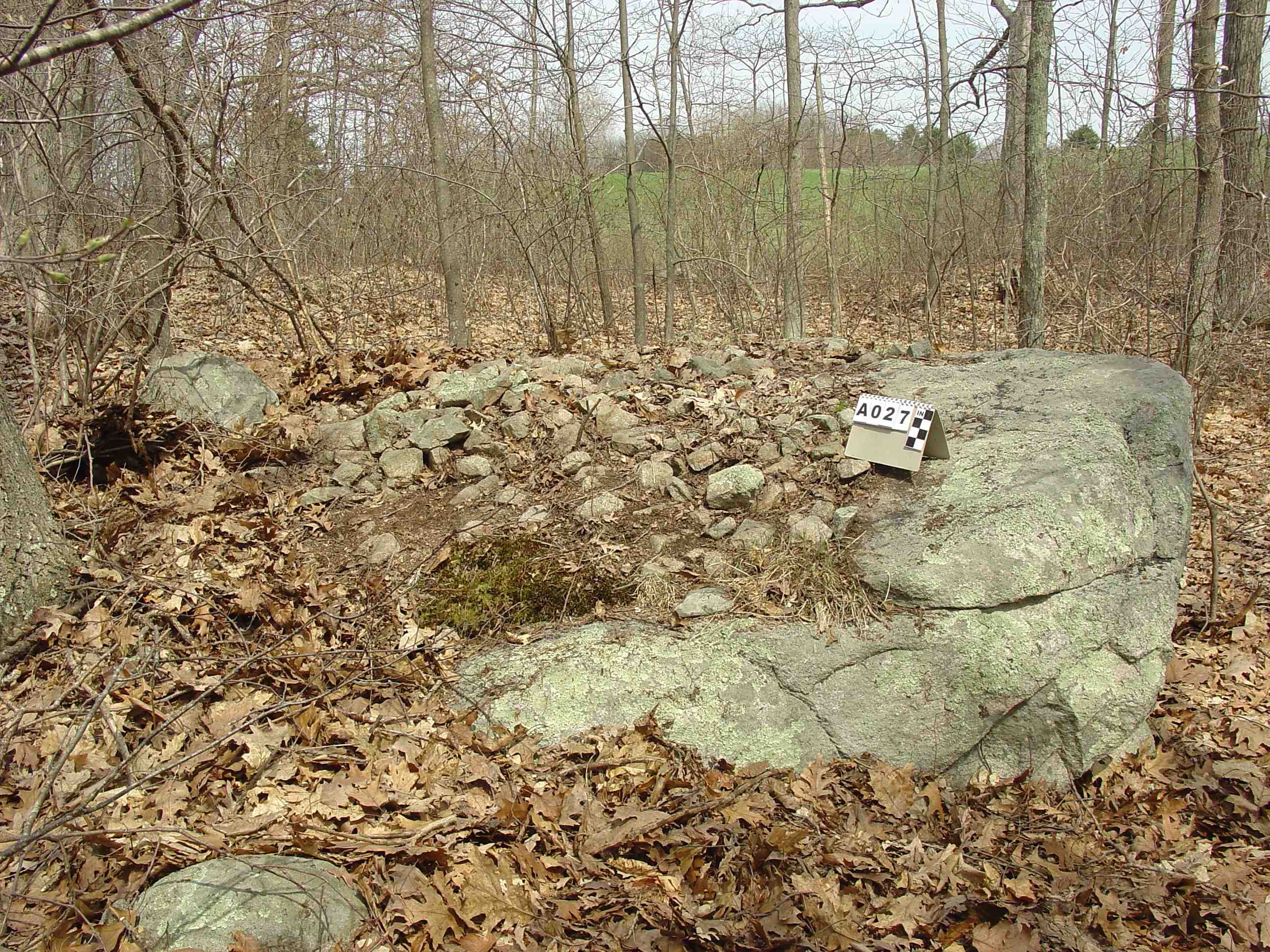
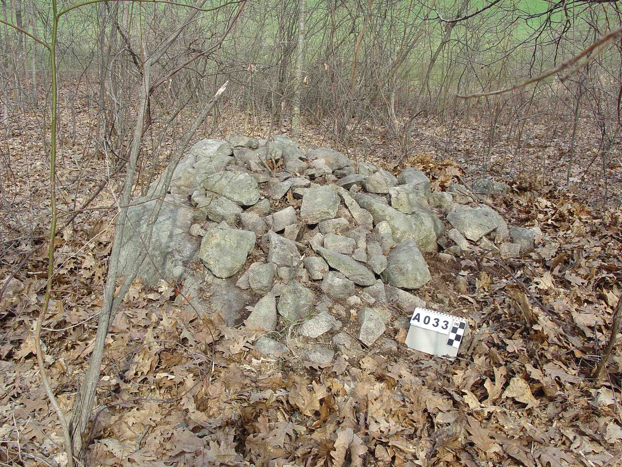
2) Attached verses On Top Trailing to Ground designs with a few exceptions are indistinguishable. Many of the base stones have a slanted side. The cairns were built up the slanted sides, some to the top of the base stone others about half ways up. There is a mix of single layer, non-mound and mound. In both designs the cairn stones are in contact with the earth and the base stone. The two designs dominate the cairn designs with a total of fifteen. They make up half the cairns in the cairn field.
3)Double cairns are interspersed in the cairn field. These are two cairns build upon the same base stone. A clear delineation can be seen between the two cairns. There are six double cairns.
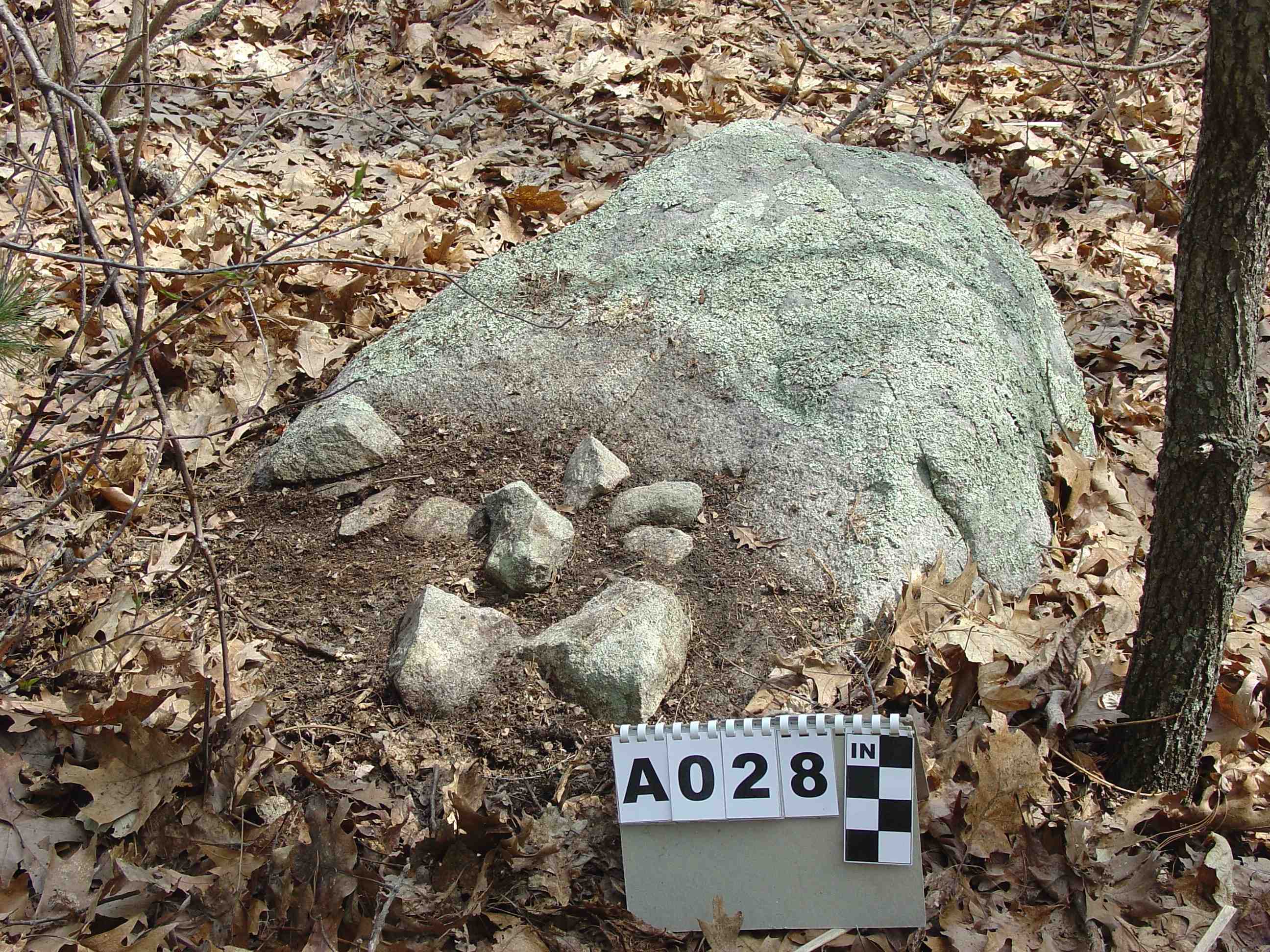
4) On Top of Boulder cairns have a mix of single layer, non-mound and mound. There are seven cairns one being special with four stones.
5) Four Stones on Top cairn stands out because it is the only cairn with a small quantity of stones.
6) On Ground cairns are in the minority. Cairns associated with a base stone far out number the two on ground cairns. That suggests the two on ground cairns had symbolic significance.
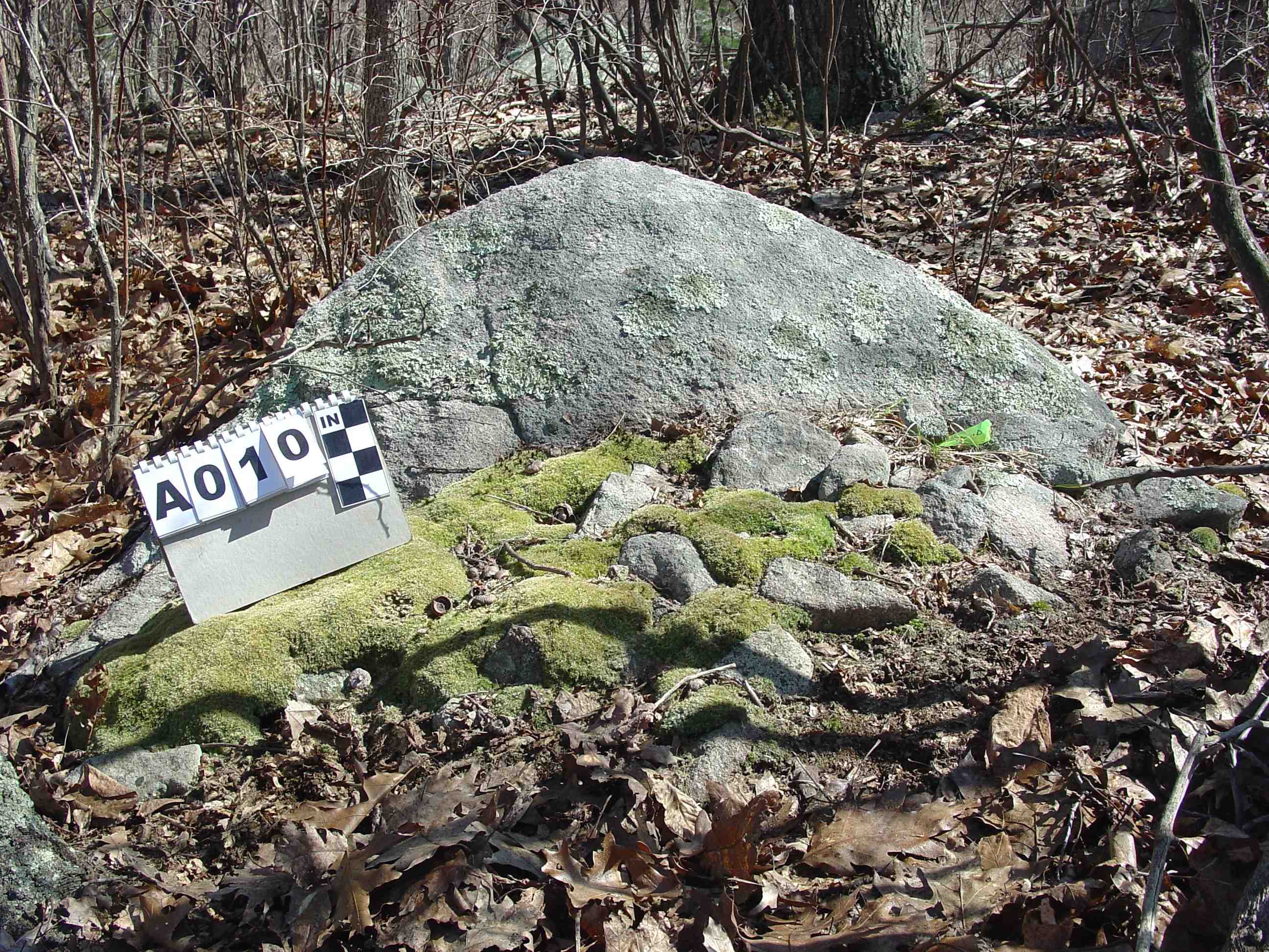
7) The height of base stones varies from 6 inches up to 3 feet. There does not seem to be any significant difference or preference. The Native Americans appear to have used what was available.
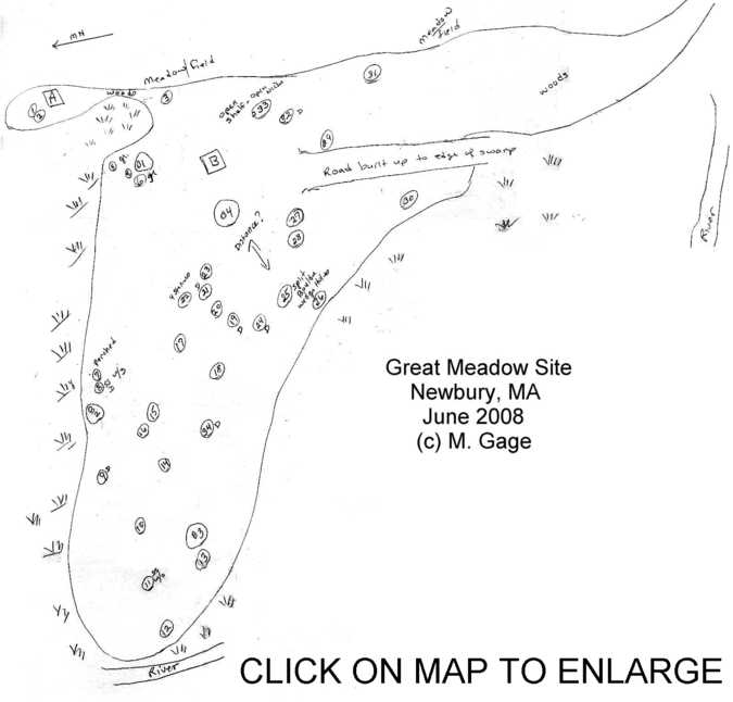
Layout of Sections
Section A
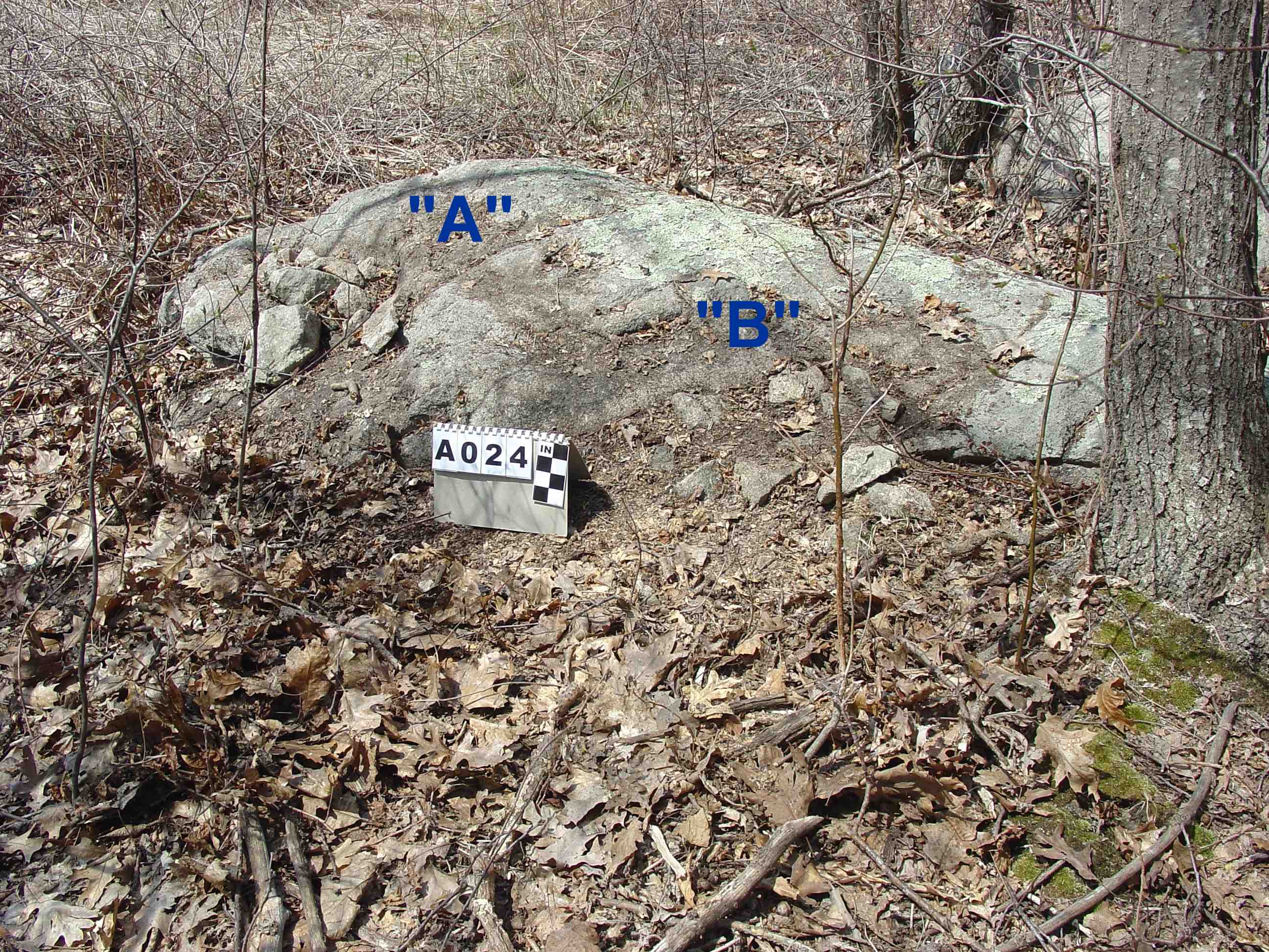
Section A is located on a small strip of woods and dry land adjacent to wetlands on the northwest and south sides which cuts it off from section B. On the north and northeast side it is bordered by the meadow. It contains two cairns, one on top and one attached. They are regular, common cairns. The cairns stand out only because they are separated from the main cairn field.
Section B
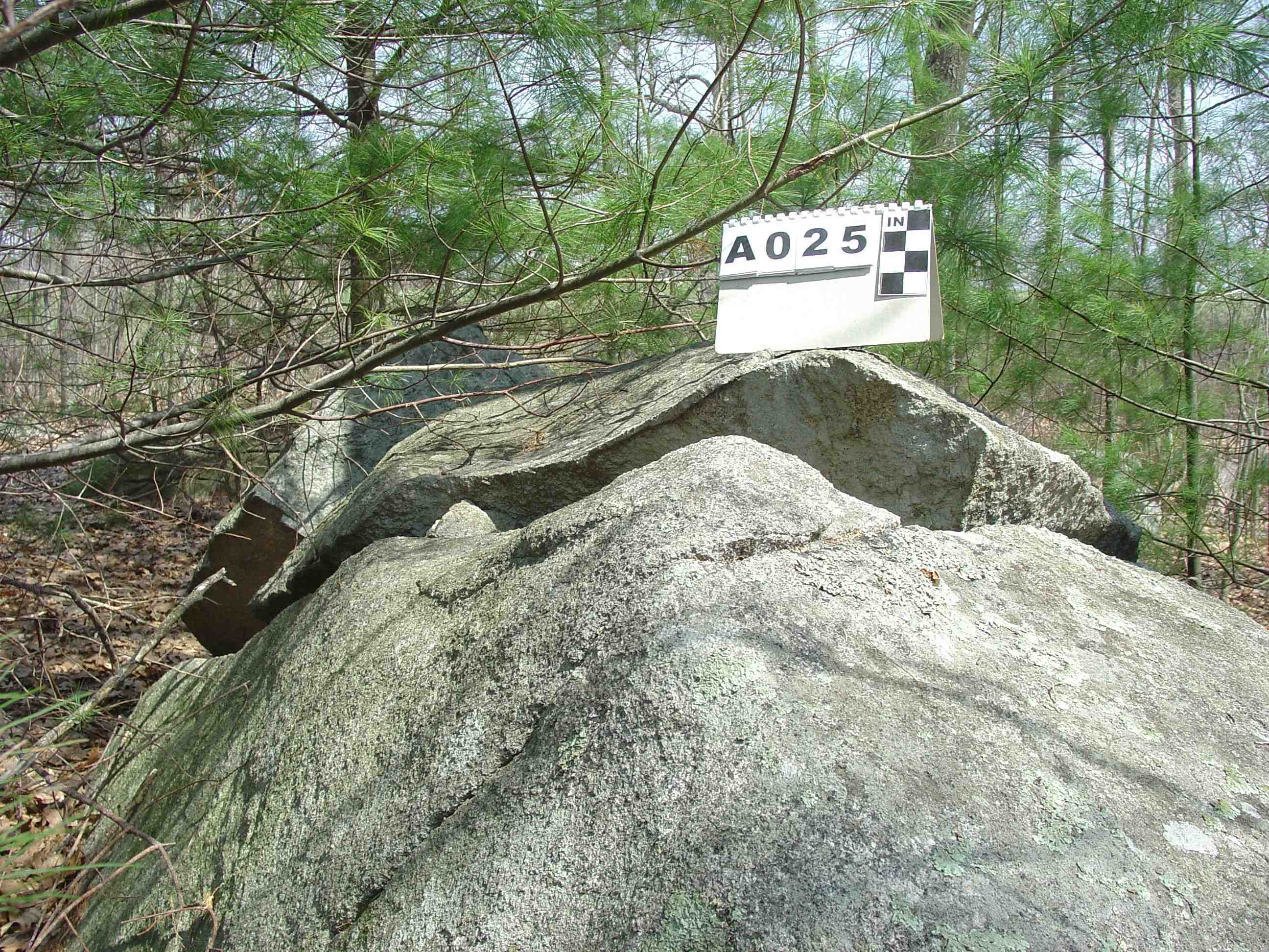
Section B is at the base of a long down slope of meadow. The meadow borders the cairn field on the east side. The cairn field is in the woods. The south, west and north sides of the cairn field border wetlands. The wetlands in turn border a tidal river. The cairn field contains thirty one cairns, one quarried boulder, and four ex-large boulders.
A thick narrow strip of impenetrable woods connects section A and B. At the edge of this strip adjacent to the meadow on the east side and set apart from the other cairns is an On Top Trailing to Ground cairn approximately six feet diameter.
Three boulders form a triangular enclosed space on the north side. The triangle is elongated and borders the north side, one long side on the edge of woods/dry land next to wetlands. The other long side and shorter base are on the interior of the site. Boulder B1 has three cairns are associated with it. Boulder B2 has two cairns are associated with it. Boulder B3 has no cairns are associated with it.
Boulder B2 is of interest in that is has a perched slab cairn (#7) and a split stone cairn (#8) on the dividing line between dry land and wetlands. The two cairns and boulder form the northwest tip of the boulder triangle. Boulder B1 has an on ground cairn (#6) next to it and two other cairns, another on ground cairn (#4) and attached to boulder cairn (#5) nearby forming a small group of three. This set of cairns and boulder are near the dry land and wetlands division.
The split stone cairn (#8) is midway on the north side between the west and east sides. Further west and towards the south side is the other split stone cairn (#11). This places the split stone cairns on the opposite side of where the two on ground cairns (#4 & #6) are located on the north east side.
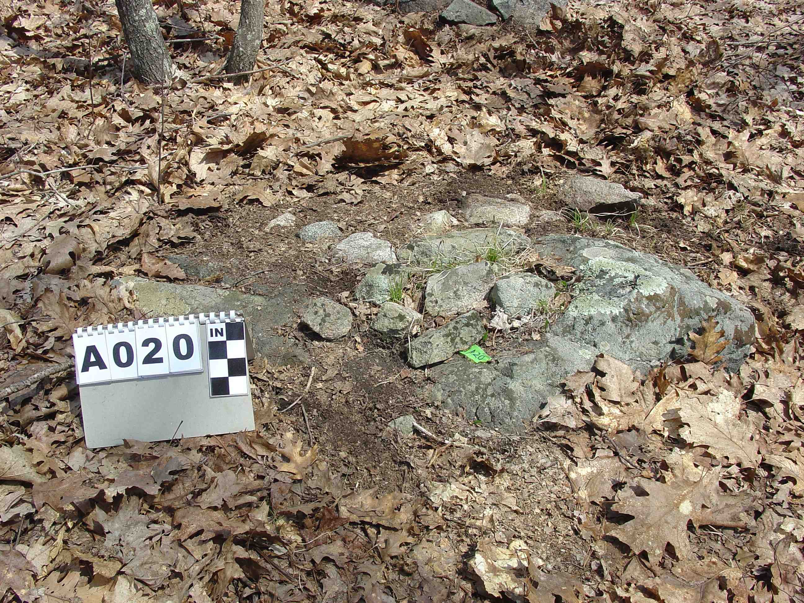
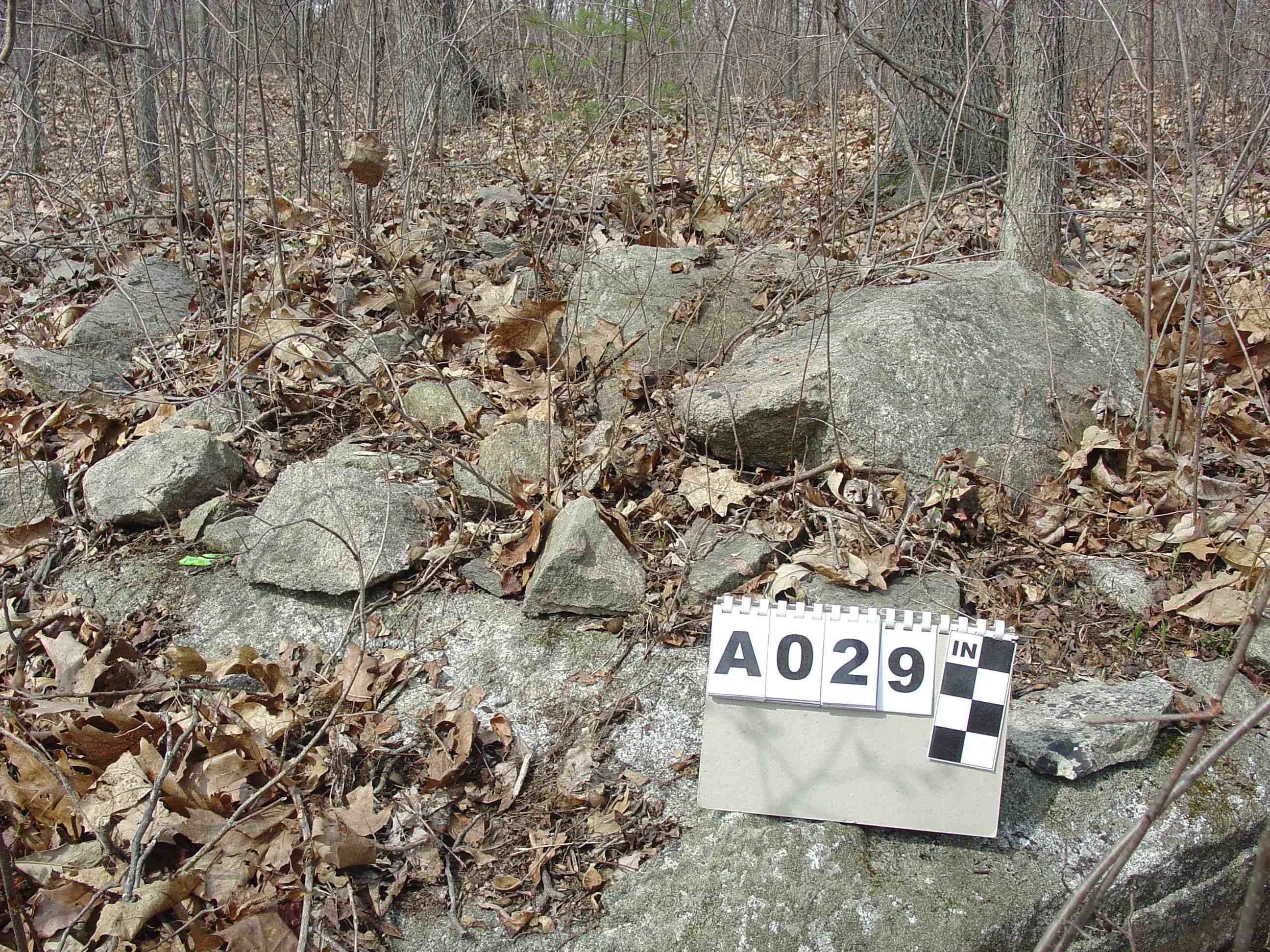
On the edge of the south side there are four cairns. Numbers 12, 26 and 30 are on the edge of the dry land and wetlands. Number 31 is the south most cairn and is separated from the other cairns. Numbers 12 and 26 are similar each is attached to the side of a high (3-39) base stone. The cairns are half ways up each base stone on the north side the dry land side towards the cairn field. Numbers 30 and 31 have similar designs. Number 30 follows #12 & #26 in the high base stone category with 38 high. It differs from #12 & #26 in that is has cairn stones from the base, not touching the ground, up to the top. Number 31 has a lower base stone with a height of 8. It has cairn stone covering the top and trailing off on the east and north sides. Basically #12 & #26 only differ in that the cairn stones cover less of the top portion of the base stone than #30 and #31. The only reason they stand out is these cairns are on the outer edge of the site, three being on the immediate dividing zone of dry land verses wetlands.
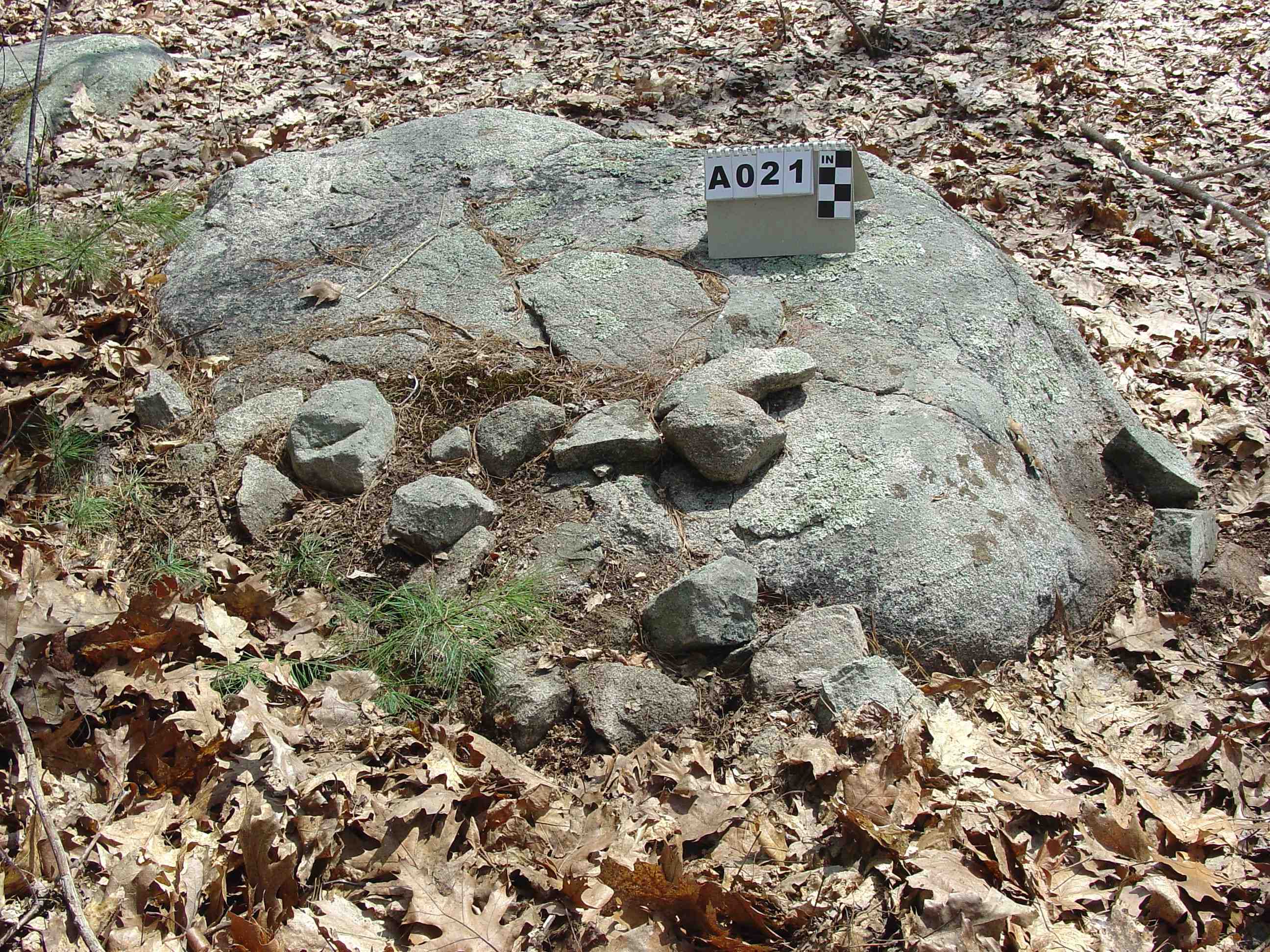
Cairn #33 with the shelf-niche is located on far west side lining up approximately with the middle of the bottom of the triangular area. The shelf-niche faces the triangular area. Boulders B1 and B3 are in easy viewing range.
Cairn #11 the split stone cairn with stone surrounding the base and a split without stone fill is located on the southwest end. Only one cairn is beyond it #12. Boulder B4 is nearby along with cairn #13 a low mound attached to two boulders.
The rest of the cairns are located southwest, south and southeast of the boulder triangle formation. The dirt road bisects the cairn field on the southeast side. It is not known if any cairns were destroyed by it. One cairn was definitely saved as evidence of the cairn (#29) being attached to the edge of the roadbed. The cairns that dot the landscape on the interior are primarily associated with a base stone. Double cairns are mixed in with single cairns. There does not appear to be any particular pattern to the layout.
Soil Survey
The site is located in a narrow strip of woodland between the gentle rolling hills with hay fields on the east and the marsh land along the Parker River to the west and south. The USDA Soil Survey of Essex County, Massachusetts Northern Part (1981) lists the field soils as SsB & SsC - Suffield silt loam which is good grade of farm land free from stone. This explains the lack of any field clearing stone piles. The marshland is designed IW - Ipwsich and westbrook mucky peats. The cairn site itself is located on a small strip of land designated RnC - Rock outcrop - Buxton complex - It is further described as Most areas of this complex are in woodland, and the complex is suitable for trees and woodland wildlife habitat. The areas of exposed bedrock interfere with timber harvesting equipment. The exposed bedrock and the stones on the surface make the complex poorly suited to farming and limit recreational development. The limited topsoil has a maximum depth of four inches. Observations during the field research of the cairn sites found large areas in the cairn site with gravel surface and virtually no noteable topsoil. This explains the extremely limited historical usage of this area. It had no economical value as farmland. It was strictly suited as small woodlot harvested by hand.
INTERPRETATION
Native American
Two cairns are separated and isolated from the main area (section A). The land area is small suggesting this may have been a preparation area for the shaman.
Cairn #3 is a large low cairn with stones on top trailing to the ground. It is separated from the rest of the cairns in section B. It is at the junction where the strip of land connecting section A and section B meet. This cairn appears to be at an entrance point. Cairn #31 on the far opposite end but on the same side as cairn #3 is another low cairn with stones on top and trailing to ground on two sides. It is near the road coming in from the wetlands/river area. It may be another entrance and entrance cairn. Stone offerings were probably made when a person entered the site.
On the south side of the site there are three cairns on the dividing line between dry land and wetlands. Each one has a tall base stone (3, 39, 38). Each one has stone on interior side (cairn field side). Two have stones on the ground up half ways on the boulder and one has stone on the side of the boulder from top to bottom but not on the ground. The river skirts this side of the site beyond the wetlands. The purpose of these three cairns is unknown.
Many cairns are partially buried obscuring their actual size. Those above ground range in size from 16 to 6 wide. Several are in the 5 to 6 range indicating a limited number of people contributed stones to the cairns. In comparison there is one cairn with four stones, suggesting a shaman built that cairn designating the site.
The naturally formed triangular area defined by three ex-large boulders lacks cairns on the interior with the exception of two next to boulder B2. The rest of the cairns are outside the triangle. The enclosed space easily could hold a small group of people. Just outside of the enclosed area on the east side is the shelf-niche facing towards it. Niches were used to place a perishable offering. A perishable offering indicates an unknown spirit was called forth to the ceremony. Next to boulder B2 on the tip of the enclosed area is a split stone cairn. Split stone cairns as a general category show the Underworld Spirit was invited to the ceremony. This split stone cairn is just inside the triangle. There are three stones inside the split. These stones may have been used symbolically to block out uninvited spirits from the spirit portal. The cairn also has stones placed on top of the base stone suggesting a stone offering was made to the Underworld Spirit to call the spirit forth into the enclosed area. The triangular enclosed area was a sacred place where people and two spirits came together.
The enclosure is situated on the dividing line between wetlands and dry land. The river does not come close to this section of wetlands. The shelf-niche faces north which is the direction of the triangle. There does not seem to be a way to identify the second spirit.
The second split stone cairn is south of the triangle. Its split does not have any stone fill. There is a cairn on the ground attached to the split stone. This split stone cairn functioned by people placing a second stone offering to the Underworld Spirit to call it over to the cairn where the spirit could re-enter the Underworld after the ceremony. Formality was an important part of the ceremony and making sure the Underworld Spirit got back into the Underworld was critical.
The location of the site was probably governed by several factors. First, by the presence of two split stones. Second, the presence of natural ex-large boulders arranged in a triangular formation enclosing an appropriately sized area. The boulders were not a necessary feature as an enclosure or enclosed space could be built but having it occur naturally probably enhanced the site location. The wetlands appear to have an unknown influence on the site.
Historic Usage
A short length of roadbed was built up. It extends from the edge of the open wetlands where the river can be seen a short distance away into the dry land within the woods. Once inside the woods it was not necessary to extend the road further as there was naturally occurring dry land. The location of the road provided the easiest access from the meadow to the river. The meadow land and surrounding lands were part of a large land grant in 1635 when the town of Newbury was established. It is not known who or when the road was built. The river is tidal and therefore has a steady stream of water with good depth at least part of each day. It was used in historic times to ship goods down to Newbury where there was a harbor and connection to the ocean. The road indicates a crop of either hay or other plant was harvested and shipped via river.
A single ex-large boulder has flat wedge quarry holes. A single chunk was quarried loose from the top of the boulder but never removed. The boulder was abandoned. No other boulders have quarry marks. This suggests a quarrying project was started but ended immediately and no other attempt of splitting stone was undertaken. The quarried boulder does not appear to have anything to do with the roadbed.
Small tractor dug test pits show a developer once tested the land for drainage. These have been left open as shallow open pits. This project likewise was abandoned.
The whole area has been turned into conservation land. The open meadows are still hayed by a local farmer.
CONCLUSION
Many of the cairns are partially buried by humus. This indicates the cairns have been there a long time. There are no stone piles along the edge of the woods and the meadow due the lack of stones in the field soils. The rocky soils of the cairn site made that small portion of the farm property useless for farming purposes. The scientific evidence from the soil survey eliminates any possibility that these are field clearing piles. There was simply no reason to attempt to field clear land which had no farming value.The trees along the edges of the meadows are medium sized indicating the wood has been harvested over the years. Wood cutting (non-mechanized) appears to be the only historic usage with the exception of one attempt to quarry the large boulders in this area.
The diversity of cairn designs indicates this was a sacred Native American ceremonial site.
|